
Soil/Landform Unit - Fairview plains
 Plains north of Mt Arapiles |
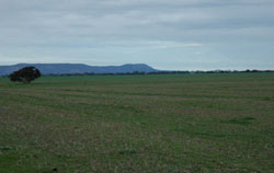
0.09% of CMA region Located directly south of the Little Desert, the Fairview plains comprise two units, one within the Douglas Depression while the other abuts the southern boundary of the Little Desert further west. Occurring within the low ridge tops with remnant aeolian sands and flats south of the Little Desert (5.5.2), the landscape comprises plains with swamps and bordering sand dunes. Soils include brown and grey cracking clay soils (Vertosols) on plains and swamps with texture contrast variants present as part of bordering sand dunes. Sandy surfaces of dunes are likely to be susceptible to wind and sheet erosion where exposed. Clay soils may experience periodic waterlogging during wet seasons. There are a number of ecological vegetation communities on the plains including Heathy Woodland on well-drained sandy soils, Plains Woodland on poorly drained soils and Low Rises Woodland, Red Gum Wetland, Ridged Plains Mallee, Plains Savannah and Shallow Sands Woodland. | 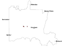 |
 Plains to the west of Duchembegarra used as pastoral runs | 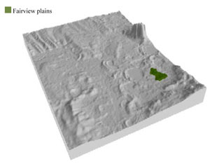 |
| 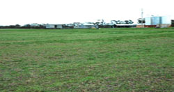 Cropping and grazing are major land uses |
Component | 1 | 2 | 3 |
Proportion of soil-landform unit | 10% | 15% | 75% |
| CLIMATE Rainfall (mm) | Annual: 470 | ||
| Temperature (oC) | Minimum 8, Maximum 21 | ||
| Precipitation less than potential evapotranspiration | September–April | ||
| GEOLOGY Age and lithology | Neogene marine sand and silt (Parilla Sand); Quaternary paludal silt and clay; Quaternary aeolian dune sand (Lowan Sand) | ||
| Geomorphology | |||
| LANDUSE | Uncleared areas: Nature conservation Cleared areas: Dryland cropping; sheep grazing | ||
| TOPOGRAPHY Landscape | Gently undulating plains | ||
| Elevation range (m) | 117–173 | ||
| Local relief (m) | 3–5 | ||
| Drainage pattern | – | ||
| Drainage density (km/km2) | 0.1 | ||
| Landform | Plains | ||
| Landform element | Swamp | Bordering dune | Plain |
| Slope and range (%) | 3 (1-7) | 5 (3-10) | 2 (1-8) |
| Slope shape | Concave | Convex | Straight |
| NATIVE VEGETATION Ecological Vegetation Class | Low Rises Woodland (37.7%), Shallow Sands Woodland (15.1%), Heathy Woodland (13.8%), Ridged Plains Mallee (13.0%), Plains Savannah (10.6%), Other (9.7%) | ||
| SOIL Parent material | Swamp silt and clay | Aeolian sand | Fluvial silt, sand and minor gravel |
| Description (Corangamite Soil Group) | Grey and brown cracking clay soils (37) | Sodic brown, yellow and grey texture contrast soils (38) | Grey and brown cracking clay soils (37) |
| Soil type sites | LS3, LSWW9, LSWW5 | LSWW11, LSWW17, LSWW13 | LS3, LSWW9, LSWW5 |
| Surface texture | Medium clay | Loamy sand | Medium clay |
| Permeability | Slow | Moderate - high | Slow |
| Depth (m) | > 2 | > 2 | > 2 |
| LAND CHARACTERISTICS, POTENTIAL AND LIMITATIONS Critical land features, processes, forms | Susceptible to seasonal inundation and waterlogging. Slightly susceptible to surface sheet erosion where soils are exposed. Surface soils friable and only slightly susceptible to wind erosion. | Susceptible to wind and sheet erosion where exposed and surfaces with little organic matter. Susceptible to compaction where hardsetting and restricted drainage. Low inherent soil fertility. | Susceptible to inundation and waterlogging in lower areas, but can be variable due to micro relief (gilgai). Slightly susceptible to surface sheet erosion where soils are exposed. Surface soils are friable and only slightly susceptible to wind erosion. Soils susceptible to compaction at critical moisture contents. |
© State of Victoria (Agriculture Victoria) 1996 - .

This work, Victorian Resources Online, is licensed under a Creative Commons Attribution 4.0 licence. You are free to re-use the work under that licence, on the condition that you credit the State of Victoria (Agriculture Victoria) as author, indicate if changes were made and comply with the other licence terms.
The licence does not apply to ‘branding’ or some ‘images or photographs’ that may be owned by third parties. We ask you to seek prior approval to use images using the VRO feedback form. Access to higher quality images can also be provided on request.
This page was last updated on .