
Soil/Landform Unit - Benayeo gilgai plains
 Lower slopes with slopes leading to gentle rise crests |
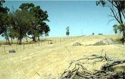
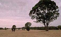
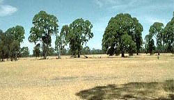
0.82% of CMA region Gently undulating plains in the west of the region comprise the Benayeo gilgai plains soil-landform unit. This unit (originally identified by Blackburn in 1956) consists of level plains and playa plains with swamps between slight undulations. The unit is sharply defined from neighbouring Apsley plains to the south and Tallageira to the north. The soil-landform unit extends west into South Australia and has a general fall to the west. Grey and brown cracking clay soils (Vertosols) and sodic brown, yellow and grey texture contrast soils (Sodosols) occupy these gilgai plains. Gilgai plains are susceptible to periodic inundation, waterlogging and soil salinity especially during late winter and early spring where rainfalls are significant. The poorly drained plains are dominated by Plains Woodland. Other areas feature vegetation communities such as Damp Sands Herb-rich Woodland, Red Gum Wetland, Drainage-line Woodland and Damp Sands Herb-rich Woodland/Shallow Sands Woodland Mosaic. | 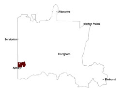 |
 Gentle to rolling plains | 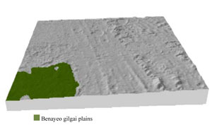 |
|
|
Component | 1 | 2 |
Proportion of soil-landform unit | 95% | 5% |
| CLIMATE Rainfall (mm) | Annual: 580 | |
| Temperature (oC) | Minimum 8, Maximum 21 | |
| Precipitation less than potential evapotranspiration | October–April | |
| GEOLOGY Age and lithology | Quaternary paludal silt and clay; Quaternary aeolian dune sand (Lowan Sand); Neogene marine sand and silt (Parilla Sand) | |
| Geomorphology | ||
| LANDUSE | Uncleared areas: nature conservation Cleared areas: dryland grazing; sheep grazing | |
| TOPOGRAPHY Landscape | Gilgai plains | |
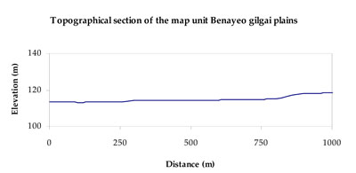
| Elevation range (m) | 97–136 | |
| Local relief (m) | 2 | |
| Drainage pattern | Absent to rare dendritic | |
| Drainage density (km/km2) | 0.1 | |
| Landform | Plains | |
| Landform element | Level plain | Playa |
| Slope and range (%) | 1 (0-3) | 0 (0-2) |
| Slope shape | Straight | Concave |
| NATIVE VEGETATION Ecological Vegetation Class | Plains Woodland (73.1%), Red Gum Wetland (13.5%), Other (6.7%) | |
| SOIL Parent material | Marine sand, silt and clay | Marine sand, silt and clay |
| Description (Corangamite Soil Group) | Grey and brown cracking clay soils (37) | |
| Soil type sites | LS3, LSWW9, LSWW11 | LS3, LSWW9, LSWW5 |
| Surface texture | Sandy clay loam to light clay | Medium clay |
| Permeability | Moderate to slow | Slow to very slow |
| Depth (m) | > 2 | > 2 |
| LAND CHARACTERISTICS, POTENTIAL AND LIMITATIONS Critical land features, processes, forms | Surface soil susceptible to wind erosion where exposed. Susceptible to compaction where hardsettingand restricted drainage. | Susceptible to inundation, waterlogging and soil salinity. Slightly susceptible to surface sheet erosion when soils are exposed. Surface soils friable and only slightly susceptible to wind erosion. Soils susceptible to compaction at critical moisture contents. |
© State of Victoria (Agriculture Victoria) 1996 - .

This work, Victorian Resources Online, is licensed under a Creative Commons Attribution 4.0 licence. You are free to re-use the work under that licence, on the condition that you credit the State of Victoria (Agriculture Victoria) as author, indicate if changes were made and comply with the other licence terms.
The licence does not apply to ‘branding’ or some ‘images or photographs’ that may be owned by third parties. We ask you to seek prior approval to use images using the VRO feedback form. Access to higher quality images can also be provided on request.
This page was last updated on .