
Soil/Landform Unit - Bangerang prior stream plains
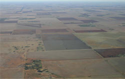 Prior stream plains near Bangerang (prior strems can be observed in colour tone changes of soils) |
0.36% of CMA region Prior stream plains near Bangerang are located within the north-east of the Wimmera CMA region. As part of a transitional landscape (from Wimmera to Mallee) and representing historic drainage pathways, plains are dominated by cracking clay soils with minor sodic red texture contrast to red calcareous variants also occurring. Soils are often gilgaied with variable soil-moisture potential between mounds and depressions of these microtopographic landscape features. As a result, boron may be an issue especially where associated with depressions. Lunettes can be found, usually as isolated features that represent eastern extents of former floodplains and swamps. Land use is mainly cropping with soil compaction an issue where cracking and sodic soils have a lower resilience to cultivation and other forms of soil structure decline. Main types of remnant vegetation present include Low Rises Woodland, Ridged Plains Mallee, Low Chenopod Shrubland, Plains Grassland, Plains Woodland and Plains Savannah. | 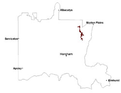 |
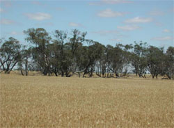 Remnant black box stand in an old ox-bow of a former stream | 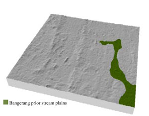 |
|
|
Component | 1 | 2 | 3 |
Proportion of soil-landform unit | 55% | 35% | 10% |
| CLIMATE Rainfall (mm) | Annual: 360 | ||
| Temperature (oC) | Minimum 9, Maximum 22 | ||
| Precipitation less than potential evapotranspiration | September–April | ||
| GEOLOGY Age and lithology | Neogene marine sand and silt (Parilla Sand); Quaternary fluvial silt, sand and minor gravel (Shepparton Formation) | ||
| Geomorphology | |||
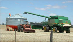
| LANDUSE | Uncleared areas: Nature conservation Cleared areas: Dryland cropping; sheep grazing | ||
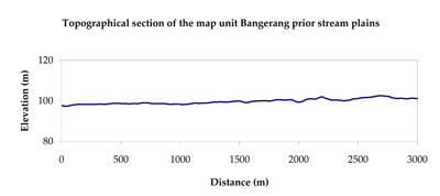
| TOPOGRAPHY Landscape | Plains with prior streams | ||
| Elevation range (m) | 95–125 | ||
| Local relief (m) | 3 | ||
| Drainage pattern | Dendritic | ||
| Drainage density (km/km2) | 0.3 | ||
| Landform | Plains | ||
| Landform element | Gently undulating plain | Level prior stream plain | Lunette |
| Slope and range (%) | 2 (1-6) | 1 (0-3) | 4 (1-7) |
| Slope shape | Straight | Concave | Convex |
| NATIVE VEGETATION Ecological Vegetation Class | Plains Savannah (56.1%), Ridged Plains Mallee (16.2%), Plains Woodland (16.2%), Other (2.5%) | ||
| SOIL Parent material | Fluvial and marine sand, silt and clay | Fluvial silt, sand and minor gravel | Aeolian sand, silt and clay |
| Description (Corangamite Soil Group) | Cracking clay soils (34) | Cracking clay soils (23) | Cracking clay soils (34) |
| Soil type sites | |||
| Surface texture | Medium clay | Light clay | Medium clay |
| Permeability | Moderate | Very slow | Moderate |
| Depth (m) | > 3 | > 2 | > 3 |
| LAND CHARACTERISTICS, POTENTIAL AND LIMITATIONS Critical land features, processes, forms | High clay content results in restricted soil drainage, but can be variable due to micro relief (gilgai). Slightly susceptible to surface sheet erosion where slopes occur. Surface soils are friable and only slightly susceptible to wind erosion. Soils may be susceptible at critical moisture contents and have variable resilience to compaction. | Flat areas susceptible to inundation and waterlogging, but can be variable locally due to micro relief (gilgai). Surface soils generally not friable and are susceptible to compaction (less structure). | Slightly susceptible to surface sheet erosion where slopes occur. Surface soils are friable and only slightly susceptible to wind erosion due to self-mulching and massive nature. Soils may be susceptible at critical moisture contents and have variable resilience to compaction. |
© State of Victoria (Agriculture Victoria) 1996 - .

This work, Victorian Resources Online, is licensed under a Creative Commons Attribution 4.0 licence. You are free to re-use the work under that licence, on the condition that you credit the State of Victoria (Agriculture Victoria) as author, indicate if changes were made and comply with the other licence terms.
The licence does not apply to ‘branding’ or some ‘images or photographs’ that may be owned by third parties. We ask you to seek prior approval to use images using the VRO feedback form. Access to higher quality images can also be provided on request.
This page was last updated on .