
Pendergast (Symbol: Pt)
EG108
Geology
Colluvium from Triassic granites, volcanic plugs and dykes.
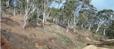
Landform
Undulating to low hills. Slope gradients are generally less than 10% with a relief of 9 -30 m.
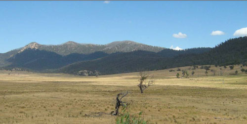
Pendergast map unit: gentle cleared slopes in the right middle ground; Morass map unit: level plain in the foreground;
Macfarlane map unit: steep hills in the background.
| Soils These soils have mostly developed on colluvium derived from the granites. It is not possible to give a definite description of these soils as they vary from gravels overlying gravelly sands to clay loams overlying clays. Land use Most of the cleared land is used for grazing. Site EG108
 Insert on side Pendergast C3 profile on right hand side |
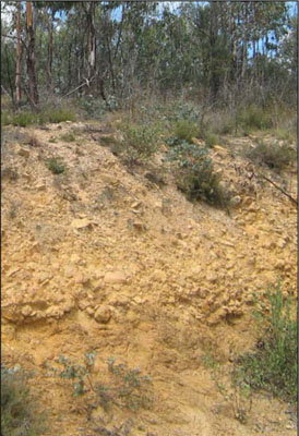 Photo: Gravelly colluvium overlying decomposing granite. |
Soil profile morphology
| Surface soil | 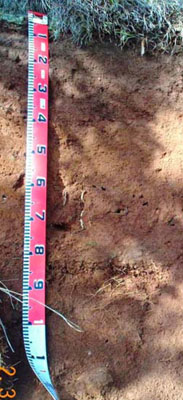 | ||
| A11 | 0 – 20 cm | Dark reddish grey (5YR4/2); sandy loam; moderate polyhedral structure; weak consistence moist; slight (2 – 10%) amounts of fine gravel (2 – 6 mm); gradual change to: | |
| Subsoil | |||
| B1 | 20 – 40 cm | Reddish brown (5YR4/4), sandy clay loam; moderate prismatic structure; firm moderately moist; slight (2 – 10%) amounts of fine gravel (2 – 6 mm); gradual change to: | |
| B2 | 40 – 70+ cm | Reddish brown (2.5YR4/4); sandy light clay ; moderate prismatic structure; firm moderately moist; moderate (20 – 50%) amounts of fine gravel (2 – 6 mm). | |
Key profile features
| |||
Soil profile characteristics
| Horizon | Depth cm | Field texture | pH water | pH CaCl2 | EC dS/m | Coarse sand % | Fine sand % | Silt % | Clay % | Field cap. % w/w | Wilt. point % w/w | PAW* water % w/w |
| B1 | 20-40 | SL | 6.3 | 5.6 | 0.05 | 29 | 34 | 19 | 18 | 24.2 | 7.2 | |
| B2 | 40-70 | SLC | 6.3 | 5.6 | 0.05 | 24 | 28 | 14 | 33 | 25.4 | 10.2 |
| Depth | Org C# | Total N | Free Fe2O3 % w/w | Exch. Al | Exchangeable cations meq/100 g | Ca:Mg | Na % | ||||||
| cm | % | % | ppm | Ca | Mg | K | Na | Total | H | CEC | |||
| 20-40 | 4.3 | 1.1 | 0.27 | 0.06 | 5.8 | 5.1 | 10.9 | 3.9 | |||||
| 40-70 | 4.3 | 2.1 | 0.43 | 0.1 | 7.2 | 6.1 | 13.3 | 2.0 | |||||
Comment
- This soil is amongst the less gravelly soils on this map unit.
© State of Victoria (Agriculture Victoria) 1996 - .

This work, Victorian Resources Online, is licensed under a Creative Commons Attribution 4.0 licence. You are free to re-use the work under that licence, on the condition that you credit the State of Victoria (Agriculture Victoria) as author, indicate if changes were made and comply with the other licence terms.
The licence does not apply to ‘branding’ or some ‘images or photographs’ that may be owned by third parties. We ask you to seek prior approval to use images using the VRO feedback form. Access to higher quality images can also be provided on request.
This page was last updated on .