
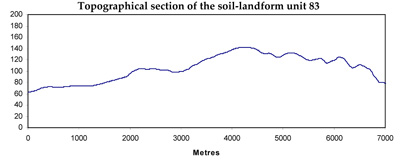
Soil/Landform Unit 83
Landform Unit Description
Page top
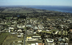 Clifton Springs |
0.03% of CMA region This small unit on the northern edge of the Neogene plateau (near Point Richards on the Bellarine Peninsula) consists of Cretaceous outcrops within a higher basaltic unit (Unit 80) to the south and within dunefields and swamps (Unit 82) to the north (part of the coastal strip). The unit components are rises and depressions. The soils are sodic brown texture contrast soils (Sodosols) sitting on thick sediments, some with dark upper soils where colluvial material from the higher basalt unit have been deposited. These soils are susceptible to compaction and structure decline when moist, and possibly mass movement. Land use is grazing, residential and horticulture. |  |
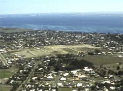 Development on these Cretaceous sediments at Clifton Springs has left little remaining outcrop of this geology on the peninsula | 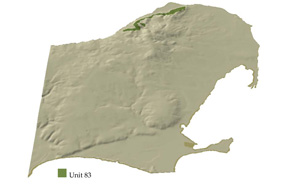 |
 |
Component | 1 | 2 |
Proportion of soil-landform unit | 80% | 20% |
| CLIMATE Rainfall (mm) | Annual: 640 | |
| Temperature (oC) | Minimum 10, Maximum 19 | |
| Precipitation less than potential evapotranspiration | October-April | |
| GEOLOGY Age and lithology | Cretaceous fluvio-volcanic sandstone and conglomerate, Paleogene tholeiites and pyroclastics | |
| Geomorphology | ||
| LANDUSE | Uncleared: Nature conservation Cleared: Sheep and beef cattle grazing; residential; horticulture | |
| TOPOGRAPHY Landscape | Undulating rises | |
| Elevation range (m) | 17-98 | |
| Local relief (m) | 10-15 | |
| Drainage pattern | Dendritic | |
| Drainage density (km/km2) | 0.4 | |
| Landform | Rises | |
| Landform element | Rise | Depression |
| Slope and range (%) | 5 (0-12) | 4 (0-10) |
| Slope shape | Convex | Concave |
| NATIVE VEGETATION Ecological Vegetation Class | Grassy Woodland (5.5%) | |
| SOIL Parent material | Fine sandstone and mudstone | Fine sandstone and mudstone |
| Description (Corangamite Soil Group) | Sodic brown gradational and texture contrast soils (5) | Sodic brown gradational and texture contrast soils (5) |
| Soil type sites | CLRA27, OTR735, CLRA40 | CLRA27, OTR735, CLRA40 |
| Surface texture | Clay loam | Clay loam |
| Permeability | Moderate | Low |
| Depth (m) | <1 | <2 |
| LAND CHARACTERISTICS, POTENTIAL AND LIMITATIONS | Texture contrast, moderate to high water holding capacity and nutrient holding capacity in the surface soil, higher in subsoi. Often sharp boundary to rock. Susceptible to compaction and structure decline when moist. Strongly structured, moderately deep and moderately rapid site drainage, moderate permeability. | Texture contrast, moderate to high water holding capacity and nutrient holding capacity in the surface soil, higher in subsoil. Often sharp boundary to rock. Susceptible to compaction and structure when moist. Strongly strutured, deep and slow site drainage, low permeability. |
© State of Victoria (Agriculture Victoria) 1996 - .

This work, Victorian Resources Online, is licensed under a Creative Commons Attribution 4.0 licence. You are free to re-use the work under that licence, on the condition that you credit the State of Victoria (Agriculture Victoria) as author, indicate if changes were made and comply with the other licence terms.
The licence does not apply to ‘branding’ or some ‘images or photographs’ that may be owned by third parties. We ask you to seek prior approval to use images using the VRO feedback form. Access to higher quality images can also be provided on request.
This page was last updated on .