
3.3.1 Dissected low hills plateaux of the Southern Uplands
|
The uplifted block of the Bellarine Peninsula forms a very weakly dissected undulating plain of low elevation (less than 150 m). Drainage from the remnant basalts of the Palaeogene Older Volcanics forms a vaguely radial pattern on the elevated plateau. A narrow strip of deeply weathered Cretaceous Otway Group rocks occurs in outcrop along the southern edge of the Curlewis Monocline, which forms the northern boundary of the peninsula. Landslides and narrow gullies have formed along the northern edge of the monocline. A sheet of marine sands of Late Neogene age covers the southern portion of the uplifted Bellarine block. | 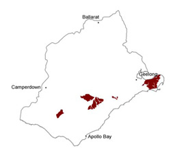 |
Soil-landform unit | Original unit ID | Unit description | Area (km2) |
209 | Undulating rises and plains (Portarlington) | 130 | |
| Deepdene L.S. | Undulating plain | 185 | |
| Gherang Gherang L.S. | Flat or gently dissected plateau remnants | 10 | |
- | Low basaltic hills (Scotchmans Hill) | 27 | |
| Tomahawk Creek L.S. | Deep valleys; dissected lateritic plateaux | 42 | |
- | Undulating rises and plains (e.g. Curlewis) | 16 | |
- | Undulating cretaceous rises (west of Portarlington) | 3 |
© State of Victoria (Agriculture Victoria) 1996 - .

This work, Victorian Resources Online, is licensed under a Creative Commons Attribution 4.0 licence. You are free to re-use the work under that licence, on the condition that you credit the State of Victoria (Agriculture Victoria) as author, indicate if changes were made and comply with the other licence terms.
The licence does not apply to ‘branding’ or some ‘images or photographs’ that may be owned by third parties. We ask you to seek prior approval to use images using the VRO feedback form. Access to higher quality images can also be provided on request.
This page was last updated on .