
Soil/Landform Unit 17
Landform Unit Description
Page top
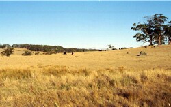 Undulating rises used from grazing east of Yendon |
0.30% of CMA region The undulating granitic rises around Yendon are part of the granitic landscapes within the Midlands of the Western Uplands. The gentle to undulating slopes graduate into prominent footslopes and alluvial flats. Remnant vegetation on the granite includes Grassy Woodland, Grassy Dry Forest, Plains Grassy Woodland and Herb-Rich Foothill Forest. The soils consist of mottled texture contrast soils with sodic medium to heavy clay subsoils. Land use is restricted to grazing and cropping due to the low available water holding capacity and ready leaching of nutrients from these soils. Gully erosion occurs to a minor extent with sheet and rill erosion. Salting can also be expressed at the surface as evidenced by the presence of spiny rush. |  |
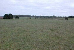 Granite rise hear Lal Lal. Photo taken in August after winter rainfall | 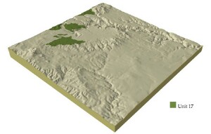 |
| 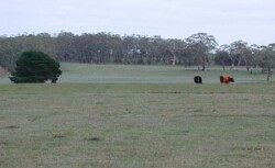 Grazing is the dominant land use upoin this soil landform unit |
Component | 1 | 2 | 3 | 4 |
Proportion of soil-landform unit | 20% | 55% | 15% | 10% |
| CLIMATE Rainfall (mm) | Annual: 790 | |||
| Temperature (oC) | Minimum 7, Maximum 17 | |||
| Precipitation less than potential evapotranspiration | November-March | |||
| GEOLOGY Age and lithology | Devonian granite and granodiorite | Quaternary gravel, sand and clay | Pleistocene basalt | Quaternary gravel, sand and clay |
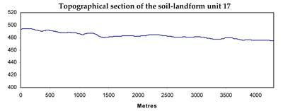
| Geomorphology | ||||
| LANDUSE | Uncleared: Nature conservation Cleared: Sheep and beef cattle grazing; limited cropping (cereal) | |||
| TOPOGRAPHY Landscape | Undulating rises | |||
| Elevation range (m) | 449-571 | |||
| Local relief (m) | 30 | |||
| Drainage pattern | Dendritic | |||
| Drainage density (km/km2) | 2.6 | |||
| Landform | Hills | Fan and terrace | Depressions | Terrace |
| Landform element | Crest and slopes | Drainage lines | Long gentle upper slopes | |
| Slope and range (%) | 6 (2-10) | 1 (1-3) | 1 (1-3) | 1 (1-2) |
| Slope shape | Convex | Straight | Straight | Straight |
| NATIVE VEGETATION Ecological Vegetation Class | Grassy Woodland (12.6%), Grassy Dry Forest (1.5%), Plains Grassy Woodland (1.1%), Herb-rich Foothill Forest (1.0%) | |||
| Dominant species | E. vininalis, E. radiata | E. ovata, E. obliqua, E. radiata | E. ovata, E. viminalis, E. rubida, E. obliqua | E. viminalis, E. radiata |
| SOIL Parent material | In situ weathered granite | Unconsolidated wash | In situ weathered basalt | Unconsolidated gravel, sand, silt and clay |
| Description (Corangamite Soil Group) | Red mottled brown, grey or yellow texture contrast soil (32) | Mottled brown, yellow or grey sodic texture contrast soil, coarse structure (35) | Dark brown soil - variable (34) | |
| Soil type sites | ||||
| Surface texture | Sandy loam | Sandy loam | Clay loam | Fine sandy clay loam |
| Permeability | Moderate | Moderate to low | Moderate to low | Moderate to low |
| Depth (m) | 1 | 1 | 1.5 | 2 |
| LAND CHARACTERISTICS, POTENTIAL AND LIMITATIONS | Hardestting surface soils lead to overland flow and are subject to gully, sheet and rill erosion on moderate slopes. Leaching of salts, subsurface flow and deep seepage are other features of this soil type. | Moderate dispersible and poorly drained soils lead to discharge sites for salinity with accumulation of salts occurring. Waterlogging and subsurface flow also occur. Harsetting surface soils may lead to overland flow and gully erosion. | Hardsetting surface soils lead to surface compaction and are subject to overland flow and sheet erosion. Slowly permeable subsoils lead to periodic waterlogging. | Low-lying areas are prone to poor drainage leading to waterlogging. Overland flow, stream bank erosion and gully erosion are other features of this soil type. |
© State of Victoria (Agriculture Victoria) 1996 - .

This work, Victorian Resources Online, is licensed under a Creative Commons Attribution 4.0 licence. You are free to re-use the work under that licence, on the condition that you credit the State of Victoria (Agriculture Victoria) as author, indicate if changes were made and comply with the other licence terms.
The licence does not apply to ‘branding’ or some ‘images or photographs’ that may be owned by third parties. We ask you to seek prior approval to use images using the VRO feedback form. Access to higher quality images can also be provided on request.
This page was last updated on .