
2.1.2 Dissected Western uplands associated with granitic rocks and aureoles
|
A diverse range of landforms are associated with the granite plutons which have been unroofed by erosion during the past 300 million years. The most common landscapes of the Palaeozoic granites are generally very subdued low hills and ridges of deeply weathered rock, such as those around Yendon and Lismore. In places, the deep weathering has produced thick (~40 m) kaolin clays, which are commercially mined at Pittong and Lal Lal. Based on oxygen isotope dates from these locations, the weathering is generally regarded as Neogene in age (Bird & Chivas 2002). However, in other locations the granites are exposed as tors (such as in the You Yangs), and as grus (such as on the flanks of Flagstaff Hill, Pittong). In some areas the metamorphic aureoles around the granites are resistant to weathering and form prominent ridges (such as the range south of Mount Bute at Pittong). | 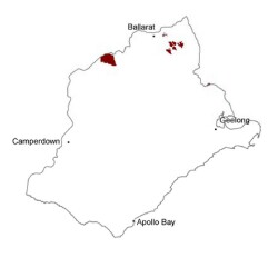 |
Soil-landform unit | Original unit ID | Unit description | Area (km2) |
70 | Low hills (Pittong) | 15 | |
264 | Rolling low hills (e.g. Anakie Junction) | 2 | |
72 | Undulating rises (Yendon) | 40 | |
38 | Colluvial footslopes and fans from granite hills (south of Pittong) | 11 | |
70 | Undlating slopes of low hills (Pittong) | 40 |
© State of Victoria (Agriculture Victoria) 1996 - .

This work, Victorian Resources Online, is licensed under a Creative Commons Attribution 4.0 licence. You are free to re-use the work under that licence, on the condition that you credit the State of Victoria (Agriculture Victoria) as author, indicate if changes were made and comply with the other licence terms.
The licence does not apply to ‘branding’ or some ‘images or photographs’ that may be owned by third parties. We ask you to seek prior approval to use images using the VRO feedback form. Access to higher quality images can also be provided on request.
This page was last updated on .