
Soil/Landform Unit 105
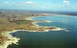 The undulating rises on teh southeastern margin of Lake Corangamite are derived from basaltic lava deposits with low stony rises, plains and depressions. |
0.03% of CMA region This unit consists of undulating rises near Nalangil at the southern most extent of the current Lake Corangamite shore. This small single unit is derived from ash, scoria and basaltic lava deposits and forms part of the volcanic Western Plains. This soil-landform unit of the Western Plains is characterised by undulating low stony rises with prominent plains and minor depressions. The remnant vegetation class of these undulating rises and plains is Plains Grassy Woodland. These plains and low rises have black gradational soils with minor occurrences of brown gradational soils and shallow friable loams, especially in combination with surface stones on crests and upper slopes of rises. The depressions also comprise the black gradational soils of the plains and rises. The ash and scoria deposits are generally friable and highly productive due to high fertility. Land use is mainly dairy farming, grazing and minor cropping. The shallow soil tend to be susceptible to waterlogging (in wet seasons) and compaction. |  |
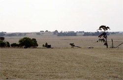 Rise and plains near Nalangil | 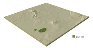 |
 |
Component | 1 | 2 | 3 |
Proportion of soil-landform unit | 20% | 35% | 45% |
| CLIMATE Rainfall (mm) | Annual: 770 | ||
| Temperature (oC) | Minimum 8, Maximum 19 | ||
| Precipitation less than potential evapotranspiration | November-March | ||
| GEOLOGY Age and lithology | Quaternary scoria and Recent clay; sand and gravel | ||
| Geomorphology | |||
| LANDUSE | Uncleared areas: Nature conservation; water supply Cleared areas: Dairy farming; sheep and beef cattle grazing; croppping | ||
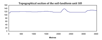
| TOPOGRAPHY Landscape | Low volcanic cones | ||
| Elevation range (m) | 117-147 | ||
| Local relief (m) | 3-10 | ||
| Drainage pattern | Centripetal | ||
| Drainage density (km/km2) | 1.0 | ||
| Landform | Volcanic cone | ||
| Landform element | Creast | Upper slopes | Lower slopes |
| Slope and range (%) | 4 (1-10) | 10 (5-20) | 5 (2-10) |
| Slope shape | Convex | Convex | Convex |
| NATIVE VEGETATION Ecological Vegetation Class | Plains Grassy Woodland (0.7%) | ||
| SOIL Parent material | In situ basalt and scoria | In situ basalt and scoria | In situ basalt and scoria |
| Description (Corangamite Soil Group) | |||
| Soil type sites | |||
| Surface texture | Clay loam to loam | Clay loam to loam | Clay loam to loam |
| Permeability | Moderate to high | Moderate to high | Moderate to high |
| Depth (m) | 0.5 | <1.5 | <1.5 |
| LAND CHARACTERISTICS, POTENTIAL AND LIMITATIONS | Friable structured soil. Soil depth may be hsallow to moderately deep with limited water holding capacity. Well drained and high nutrient holding capacity. Upper soil may be acidic. | Friable structured soil. Soil depth may be hsallow to moderately deep with limited water holding capacity. Well drained and high nutrient holding capacity. Upper soil may be acidic. | Friable structured soil. Soil depth may be hsallow to moderately deep with limited water holding capacity. Well drained and high nutrient holding capacity. Upper soil may be acidic. |
© State of Victoria (Agriculture Victoria) 1996 - .

This work, Victorian Resources Online, is licensed under a Creative Commons Attribution 4.0 licence. You are free to re-use the work under that licence, on the condition that you credit the State of Victoria (Agriculture Victoria) as author, indicate if changes were made and comply with the other licence terms.
The licence does not apply to ‘branding’ or some ‘images or photographs’ that may be owned by third parties. We ask you to seek prior approval to use images using the VRO feedback form. Access to higher quality images can also be provided on request.
This page was last updated on .