
Soils of part of the Kalkee Plains - Report No. 53
The following report "Soils of part of the Kalkee Plains - Report No. 53", March 1977, by N. S. Badawy of the former Department of Agriculture, Victoria report describes soil surveys of an area representing approximately 1,500 square kilometres bounded by Dimboola, Horsham, Rupanyup and Warracknabeal, in the Wimmera Region of Victoria. The region produces about 40 per cent of the State’s crop every year, with an average yield of approximately two tonnes per hectare.
General information, including location, climate and vegetation of the area, is outlined in some detail. Land use and management, with particular reference to soil fertility-crop rotation relationships and the extent to which soil properties in the area affect land use, are considered briefly. Special attention has been given to the significance of microscale variation and complexity of soil type in the area.
To view the information PDF requires the use of a PDF reader. This can be installed for free from the Adobe website (external link).
 | Front Page and Table of Contents (PDF 108KB) | 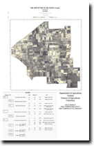 Soil Map of part of the Kalkee Plains (PDF 255KB) 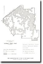 Soil Assocation Map of part of the Kalkee Plains (PDF 655KB) | |
| Section 1 - Scope and Purpose of the Investigation (PDF 487KB) | |||
| Section 2 - General Information about the Area (PDF 200KB) | |||
| Section 3 - Land Use and Management (PDF 102KB) | |||
| Section 4 - Mapping Units (PDF 111KB) | |||
| Section 5 - Soil Types (PDF 356KB) | |||
| Section 6 - Landscape Units and Soil Associations (PDF 462KB) | |||
| Section 7 - Physical and Chemical Properties (PDF 529KB) | |||
| Section 8 - Soil Relationships & References (PDF 139KB) | |||
| Appendix I - Definition of Soil Terms (PDF 121KB) | |||
| Appendix II - Distribution of Mapping Units and Soil Type Areas of Mapping Units on the Soil Type Map (PDF 109KB) | |||
| Appendix III - Site and Soil Descriptions and Analytical Data for representative profiles (PDF 176KB) | |||
| Appendix IV - Soil Survey Methods (PDF 106KB) | |||
© State of Victoria (Agriculture Victoria) 1996 - 2025.

This work, Victorian Resources Online, is licensed under a Creative Commons Attribution 4.0 licence. You are free to re-use the work under that licence, on the condition that you credit the State of Victoria (Agriculture Victoria) as author, indicate if changes were made and comply with the other licence terms.
The licence does not apply to ‘branding’ or some ‘images or photographs’ that may be owned by third parties. We ask you to seek prior approval to use images using the VRO feedback form. Access to higher quality images can also be provided on request.
This page was last updated on 25/01/2019.