
Landform
 | Wimmera Geomorphology | Elevation | 3D Catchment Overview | Land Systems |
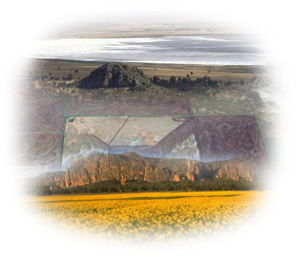
The Wimmera’s landform includes a combination of mostly plains above flood level, sandstone ridges, east-west dunes and gentle to moderate hills with a network of lakes, swamps and rivers. Like most areas north of the Victorian Highlands, the landscape is generally either flat or undulating (LCC, 1985). | 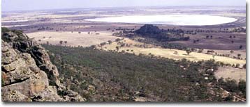 |
|
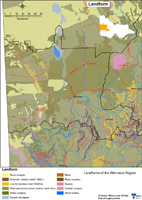
This broadscale Landform map provides an overview of the distribution of major landforms across the region. |
 |
Geology Information
Geoscience Victoria's web mapping application allows users to search geospatial databases and display the results as maps or tables. Datasets that can be viewed and interrogated include mineral, petroleum and extractive industries tenements, land-use and airborne geophysical survey boundaries, gravity, magnetic and radiometric images, bore hole & well data, surface geochemistry results, mines and mineral occurrences, and geological maps and interpretations at various scales.
© State of Victoria (Agriculture Victoria) 1996 - 2025.

This work, Victorian Resources Online, is licensed under a Creative Commons Attribution 4.0 licence. You are free to re-use the work under that licence, on the condition that you credit the State of Victoria (Agriculture Victoria) as author, indicate if changes were made and comply with the other licence terms.
The licence does not apply to ‘branding’ or some ‘images or photographs’ that may be owned by third parties. We ask you to seek prior approval to use images using the VRO feedback form. Access to higher quality images can also be provided on request.
This page was last updated on 25/01/2019.