
La Trobe River (La)
|
Geology | 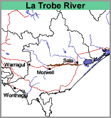 | 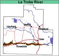 |
| Landform Flood plain. This is defined as an alluvial plain characterised by frequent active erosion and aggradation by channelled or over-bank stream flow. Original Vegetation | ||
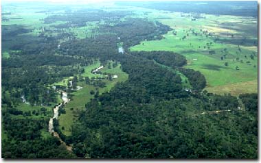 Latrobe River near Longford. | The original vegetation has been described as riverine scrubs and swamps (Lunt, 1997). Most of the area has been cleared of red gum (Eucalyptus tereticornis), although some areas along the lower part of the river appear to be naturally treeless (Drake and Poutsma, 1956). |
Previous Maps and Reports
Drake and Poutsma (1956) have mapped the soils within the La Trobe flood plain from the Glengarry Road to Lake Wellington. They recognised four soil types: La Trobe clay loam, La Trobe clay, Fernhill black clay and Glencoe peaty clay loam. La Trobe clay loam is the largest group of soils. These are the soils of the levees and better-drained portions of the flood plain. Aldrick et al. (1992) mapped the area as the Thomson land system.
Soils
The soils of the La Trobe River map unit vary according to landscape position. La Trobe clay loam occurs on the levees and better-drained portions of the flood plain. The surface soils are deep loams to clay loams with little profile development and medium clays usually occur at depth. These soils can be classified as Kandosols or Tenosols using the Australian Soil Classification.
La Trobe clay and Fernhill black clay both have clay textures throughout the profile. Glencoe peaty clay loam occurs in the swamps and wetter parts of the flood plain and has a black peaty clay loam surface soil. Deeper in the profile, the soil may be a raw peat or peaty clay. These soils can be classified as Black Vertosols using the Australian Soil Classification.
Chemical and Physical Analysis
A Kandosol (fitting the description of a La Trobe clay loam) was sampled using a soil auger (Site G4). No soil pits have been dug on this map unit.
Land Use
Drake and Poutsma (1956) have evaluated the land use potential of the La Trobe River floodplain. “Much work has been done of recent years in cleaning up, cultivating and sowing pasture but severe flooding has resulted in the rapid deterioration of such areas and the work done has been of little permanent benefit. The cleared country is mainly used for summer grazing and in favourable seasons is regarded as being quite useful for this purpose, but the difficulties of finding alternative grazing for stock during periods of flood make it impossible to take advantage of the feed available.”
Flood Risk
Probably 1 in 5 years.
© State of Victoria (Agriculture Victoria) 1996 - 2025.

This work, Victorian Resources Online, is licensed under a Creative Commons Attribution 4.0 licence. You are free to re-use the work under that licence, on the condition that you credit the State of Victoria (Agriculture Victoria) as author, indicate if changes were made and comply with the other licence terms.
The licence does not apply to ‘branding’ or some ‘images or photographs’ that may be owned by third parties. We ask you to seek prior approval to use images using the VRO feedback form. Access to higher quality images can also be provided on request.
This page was last updated on 25/01/2019.