
5.4 Clay plain with subdued ridges (Minyip)
5. North Western Dunefields and Plains (DP)
| Boundaries between the Horsham clay unit and surrounding geomorphic units vary from sharp, within a kilometre, to broad marginal areas covering up to 20 kilometres. The characteristic and distinguishing feature of this terrain are the soils of the unit; grey and brown cracking clays (often friable – self mulching), the Vertosols. In the south and south east there are fairly sharp transitions from Grey Vertosols to a variety of duplex and shallow stony soils on the Western Victorian Uplands unit. Also, west of Horsham, grey clay dominant soils end abruptly just east of the Wimmera river, although isolated areas of these friable clay Vertosols do occur west of the river. Areas of the stagnant alluvial plains near the south west corner of the unit are at the level of subdued ridges and merge imperceptibly with the extensive plains of the Goroke unit. Along the north west boundary of the unit from Dimboola north east to Birchip the clays merge with areas of dominantly Calcarosols, soils of the Woorinen formation. In the north east, the Charlton area, red Sodosols are the dominant soils. This area represents a broad boundary with the Shepparton formation of the Riverine Plains geomorphological unit. | 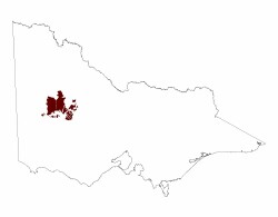 |
Geological background and origin of the Horsham clays
The self-mulching clays of the unit are essentially end products of late-Pleistocene to Holocene aeolian redistribution of lacustrine sediments from inter-ridge corridors. These clays blanket the "stranded beach ridges" which are made up of Loxton-Parrilla sandstone and were deposited as sands at a series of beaches marking still-stand stages of the retreating late-Tertiary Neogene sea. Over 100 metres of sediments deposited during much of the tertiary period lie on pre-Cainozoic bedrock east of Lake Hindmarsh just north of the unit. The non self-mulching grey clays occur on the Pleistocene to Holocene flood plains and terraces of the Wimmera River, its tributaries and effluents and on those of the Richardson and Avon Rivers. Quaternary structural deformation resulted in the capture of the north flowing Yarriambiack and Dunmunkle Creeks by the west flowing Wimmera River and in the redirection at Quantong of the later north to Lake Hindmarsh. The onset of arid conditions in this period resulted in the relative abandonment of streams such as Corker's Creek and Two Mile Creek near Longerenong and in the formation of prior stream landscapes in the south and south-east of the unit. These conditions also favoured the development of a variety of aeolian landforms which included source bordering sand sheets and longitudinal dunes, as occur on the stagnant alluvial plain south of Horsham and near the Wimmera river and, included also, are lunettes which vary greatly in size and profile development. Small lake-lunette units, several hundred metres across, occur on the stagnant alluvial plain south of Horsham and on the undulating plains north of Horsham. Lunette deposits associated with Lake Buloke extend up to 6 kilometres east of the lake bed.
Elevation, relief and slopes
Relief across most of the unit is very low, variation usually being within the range 9 to 30 metres. Surface levels of the gently undulating landscape north of Horsham vary from about 130 metres on inter-ridge corridors to about 150 metres on ridge crests. Distance between the ridge crests at Pimpinio and Jung is 26 kilometres. Floodplains of the Wimmera River south and south-east of Horsham are generally below the 140 metre contour. East of Horsham the 150 metre contour is an approximate boundary delineating the marginally higher undulating plains to the north and the floodplains to the south-east of the unit. South and south west of Horsham alluvial plains occur above the 150 and 160 metre contours. Maximum slopes in the unit occur north west of Horsham where levels fall from 150 metres on ridge crests to 110 metres near the Wimmera River within a distance of 3 kilometres.
Drainage
The main rivers in the unit are the Wimmera, the Richardson, its tributary the Avon and, in the north east, the Avoca. Rainfall on the Western Uplands outside the southern and eastern borders of the unit is the primary surface water source for these streams. With the exception of the Wimmera which flows west to Quantong before turning north to Lake Hindmarsh, all streams including the Wimmera effluents, the Dunmunkle and Yarriambiack Creeks, flow north across the undulating plains to eventually discharge in salt lakes. On the undulating plains the streams are linear, fixed (showing little evidence of migration) and have a non-tributary pattern. On the flood plains in the south east of the unit streams feeding into the Richardson River have uni-directional and integrated patterns. On a prior stream Wimmera flood plain just north-east of Horsham some streams show a reticulate or anastomotic pattern. The Wimmera River tributaries Norton Creek and Mackenzie River and the latter's tributary, Bungalally Creek, are north flowing relatively inactive streams which cross an extensive (stagnant) alluvial plain to the south of and above the Wimmera flood plain south of Horsham. This stagnant alluvial plain is gently sloping and rises from the 140 metre contour at the northern boundary to the 170 metre contour some 18 kilometres to the south. Drainage of most of the unit is essentially internal and slow and in years of above average and record rainfall, as in 1973, '74 and '83, large areas become inundated. In 1983 the 11,000 ha flooded in the Richardson - Avon basin included areas of both the south east flood plains and the undulating plains north to Donald.
Soils
Vertosols are the dominant Soil Order on both the relatively level flood plains in the south and on the gently undulating plains in the northern areas of the unit. Structural and consistence properties of the Vertosols surface soils on the alluvial plains differ from those on the undulating plains. On the alluvial plains surface soils are characteristically massive or epipedal and have a strong to very strong consistence. Subsurface sporadic bleaching may occur in these soils. On the undulating plains surface soils are characteristically self-mulching, have a weak to firm (friable) consistence and rarely have a sporadically bleached A2 horizon. Subdominant soils which also occur across the unit are Sodosols. Chromosols and Calcarosols have also been recorded.
Soil composition varies in different sub-units of the alluvial plains. On the higher level (stagnant alluvial) plains south of Horsham, the mostly Grey, but also Brown and Yellow Vertosols are associated with Brown Sodosols. In general, surface soils of both orders are slightly acid, have a low to very low salinity status, and are non-sodic. Upper subsoils are neutral to slightly alkaline, have a low salinity status and are sodic.
On the lower level flood plains, the dominantly Grey Vertosols are associated with mainly Red Sodosols. Surface soils of these Vertosols are usually slightly alkaline, have low salinity status and are non-sodic. Sub-soils are slightly to moderately alkaline, have salinity levels varying from very low to medium and are sodic. Deep sub-soils are slightly to strongly alkaline, have high to very high salinity status and are strongly to very strongly sodic. In general, surface soils of the Red Sodosols are neutral to moderately acid, have low to very low salinity levels and are non-sodic. Subsoils are moderately to strongly alkaline, have a medium salinity status and are strongly sodic. Deep subsoils are strongly to very strongly alkaline, have high to very high salinity levels and are strongly to very strongly sodic.
Dunes, interdune swales and sand sheets, the Lowan Sands, form minor landscape components within the alluvial plains. Red, Brown and Grey Sodosols occur on dunes and sand sheets. Surface soils are slightly acid, have very low salinity level and are non-sodic. Subsoils are slightly alkaline, have low to medium salinity levels and are strongly sodic. Deep subsoils are moderately alkaline, have medium salinity status and are very strongly sodic.
Grey Vertosols are strongly dominant on the plains and broad corridors between, and on the gentle slopes of, the subdued north west - south east ridges. This array of soils has been referred to as the "Kalkee" association. Surface soils are moderately alkaline, have a low salinity status and are non-sodic. Sub-soils are strongly alkaline, have a medium salinity status and are sodic. Deep subsoils are strongly alkaline, can have very high salinity status and are very strongly sodic. In some locations on the plains, there may be as little as one metre of clay above sandstone. Grey Sodosols may occur on some of the local small depressions which exist on the plains. On the upper slopes and crests of the ridges, Red Sodosols and occasionally Brown Chromosols occur together with the Grey Vertosols. This array of soils have been referred to as the "Murra Warra" association. The duplex surface soils are slightly acid, have low salinity levels and are non-sodic. Subsoils are slightly alkaline, have very low salinity levels and are sodic. Deep sub-soils are very strongly alkaline, have medium salinity status and are sodic. Red Sodosols may lie directly on sandstone which may occur as shallow as 75 centimetres in ridge areas.
Soils on gently to moderately undulating plains areas in the north east of the unit, north and north west of Charlton, are dominantly Red Sodosols. Surfaces of these soils are slightly alkaline, have low salinity status and are sodic. Subsoils are strongly alkaline, have medium salinity status and are also sodic. Deep sub-soils are very strongly alkaline, have a very high salinity status, and are very strongly sodic. Soils of this array have been referred to as the "Charlton" association.
Vegetation and land use
Although almost entirely cleared for primary production it is considered that the original broad vegetation type was a grassland - woodland complex also described as a savannah woodland sub-formation. A local, near Horsham, more detailed reconstruction described five woodland communities each dominated by a different tree species and one grassland community. Vegetation changes were related, to some extent, to soil variation. Black Box Woodland occupied lake beds, river frontages and river flats. The Buloke association was characteristic of much of the undulating plains landscape with some spear and wallaby grassland areas associated with friable grey clay soils.
Cereal cropping has been the dominant farming enterprise across most of the western two-thirds of the undulating plains. On the flood plains and alluvial plains and in areas east of Lake Buloke grazing for wool production has been a significant enterprise. These latter mixed cropping and grazing areas are also those with smaller proportions of self-mulching clays and increased proportions of non self-mulching grey clays and red texture contrast soils (Sodosols). Surface soil features which are significant in terms of reducing plant performance and cereal production include the massive and epipedal condition and the strong (non-friable) consistence of the flood plains Vertosols and the hard setting condition of many of the Sodosols.
Related information on VRO
- A Study of the Land in the Grampians Area (G T Sibley 1967)
- Soil Associations of Horsham Map sheet No. 7324 (N S Badawy 1977)
- Soils of part of the Kalkee Plains - Report No. 53 (N. S. Badawy 1977)
- Soils of the Wimmera Irrigation Area
© State of Victoria (Agriculture Victoria) 1996 - .

This work, Victorian Resources Online, is licensed under a Creative Commons Attribution 4.0 licence. You are free to re-use the work under that licence, on the condition that you credit the State of Victoria (Agriculture Victoria) as author, indicate if changes were made and comply with the other licence terms.
The licence does not apply to ‘branding’ or some ‘images or photographs’ that may be owned by third parties. We ask you to seek prior approval to use images using the VRO feedback form. Access to higher quality images can also be provided on request.
This page was last updated on .