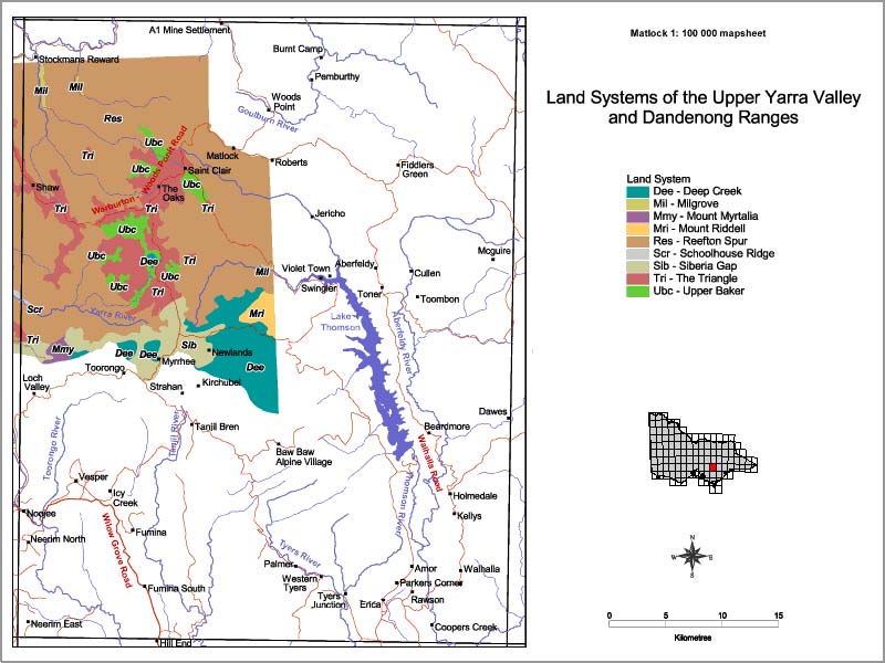
Upper Yarra Valley - Matlock
Back to: Land Systems - Upper Yarra Valley and Dandenong Ranges
This is a clickable map. Click on Land Unit in Legend for detailed information.

| Upper Yarra Valley - Land Systems Map - Matlock | ||
| Dee - Deep Creek | Mri - Mount Riddell | Sib - Siberia Gap |
| Mil - Milgrove | Rees - Reefton Spur | Tri - The Triangle |
| Mmy - Mount Myrtalia | Scr - Schoolhouse Ridge | Ubc - Upper Baker |


