
Upper Yarra Valley and Dandenong Ranges
This report details the results of the participation by the Soil Conservation Authority in the Upper Yarra and Dandenong Ranges Land Management and Stream Environments Study (Volume 3 - A Study of the Land). It is based on a 1975 investigation of the land undertaken by the Authority in the Yarra River catchment. The investigation covered most of the area comprising the four shires involed in the study (Sherbrooke, Lillydale, Upper Yarra and Healesville). The report was prepared by the Soil Conservation Authority for Kinnaird Hill deRohan and Young Pty Ltd, and was published in June 1976.
To view the information PDF requires the use of a PDF reader. This can be installed for free from the Adobe website (external link).
 | Front Page and Table of Contents (PDF 274kb) | ||
| Acknowledgements (PDF 174kb) | |||
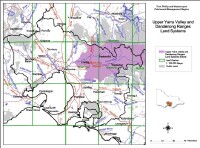
1 | Land Inventory (PDF 45kb) 1.1 Introduction 1.2 The nature of the Mapping Units 1.3 The Mapping Programme and its Consequences 1.4 Land Systems Description 1.5 Recognition of Land Systems | ||
2 | Capability Evaluation (PDF 272kb) 2.1 Introduction 2.2 Land Capability in the Study Area 2.3 Capability Assessment 2.4 Land Classes 2.5 Land Class Keys | ||
3 | Land System Diagrams (PDF 376kb) (Refer to list above for individual land systems) | ||
| Appendix 1: Soil Erosion Consideration (PDF 440kb) | |||
| Appendix 2: Physical Characteristics used in Land Component Capability Assessment (PDF 156kb) | |||
| Study Team (PDF 80kb) |

© State of Victoria (Agriculture Victoria) 1996 - .

This work, Victorian Resources Online, is licensed under a Creative Commons Attribution 4.0 licence. You are free to re-use the work under that licence, on the condition that you credit the State of Victoria (Agriculture Victoria) as author, indicate if changes were made and comply with the other licence terms.
The licence does not apply to ‘branding’ or some ‘images or photographs’ that may be owned by third parties. We ask you to seek prior approval to use images using the VRO feedback form. Access to higher quality images can also be provided on request.
This page was last updated on .