
Soil and Landform Mapping
 Port Phillip Soil/Landform Mapping | Recent Detailed Mapping: Soils and Landforms of French & Phillip Islands and the Bass Coast Soils of the Cranbourne - Koo Wee Rup Region Soils and Landforms of the Mornington Peninsula Historical Mapping for Whole Area: Soil Survey Westernport Bay Catchment |
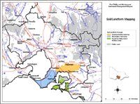
Information is provided here for a number of regional soil/landform mapping surveys - including French Island, Phillip Island and Bass Coast region, Cranbourne & Koo Wee Rup region, Mornington Peninsula Shire, and the Warragul mapsheet.
In addition, the report on the Soil Survey of the Westernport Bay Catchment (Sargeant, 1975) is available for download. Mapping for this area has been updated since this report was published and is available on this website for the areas described above.
Information for other parts of the Port Phillip and Westernport region will be made available on this website as it becomes available.

© State of Victoria (Agriculture Victoria) 1996 - 2025.

This work, Victorian Resources Online, is licensed under a Creative Commons Attribution 4.0 licence. You are free to re-use the work under that licence, on the condition that you credit the State of Victoria (Agriculture Victoria) as author, indicate if changes were made and comply with the other licence terms.
The licence does not apply to ‘branding’ or some ‘images or photographs’ that may be owned by third parties. We ask you to seek prior approval to use images using the VRO feedback form. Access to higher quality images can also be provided on request.
This page was last updated on 06/06/2019.