
NE9
| Location: Jarvis Creek | |
| General Landscape Description: Creek swamp |
Soil Profile Morphology:
Surface Soil
| A1 | 0-15 cm | Very dark grey (10YR3/1); light medium clay; moderate medium blocky, breaking down to strong fine blocky structure; pH 5.8; abrupt change to: |
| Subsoil | ||
| B21 | 15-30 cm | Pale brown (10YR6/3) with brownish yellow (10YR6/6) mottles; fine sandy light clay; weak medium blocky structure; pH 6.4; clear change to: |
| B22 | 30-40 cm | Yellowish brown (10YR5/4) with yellower brown (10YR5/8) mottles; light medium clay; moderate medium blocky structure; pH 6.7; clear change to: |
| B23 | 40-65 cm | Dark brown (10YR3/3) with a faint dark red (2.5YR4/8) mottle; medium heavy clay; strong medium blocky, breaking down to strong fine blocky structure (shiny faced peds); pH 6.8; gradual change to: |
| B24 | 65-90 cm | Brownish yellow (10YR6/6) with faint yellowish brown (10YR5/6) and red (2.5YR5/8) mottles; heavy clay; strong medium blocky, breaking down to strong fine blocky structure; slickensides present; pH 6.7. |
Key Profile Features:
- Vertic properties (i.e. significant shrink-swell characteristics).
Horizon | pH | Salinity Rating | ||
Surface (A1 horizon) | Moderately Acid | - | Non-sodic | - |
Subsoil (B21 horizon) | Slightly Acid | - | Non-sodic | - |
Deeper Subsoil (at 65-90 cm) | Slightly Acid | Very Low | NOn-sodic | None |
 |  | 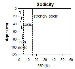 |
The surface is moderately acid. The subsoil is slightly acid. | The subsoil salinity rating is very low. | The profile is non-sodic throughout. |
Management Considerations:
Surface (A) Horizons
- The surface has a very high clay content and a moderate inherent fertility. It also has a high level of organic carbon and nitrogen which is very beneficial for plant growth. However, these measurements are best assessed by taking a bulked sample from across the paddock.
- The subsoil is non-sodic with no dispersion at depth. This is very benefical for plant growth and we observed roots down to 90 cm.
- Mottling throughout the subsoil indicates that some waterlogging is occurring within the clayey horizons.
- Planting legumes would also help to increase the low inherent fertility within the upper subsoil.
- At 65+ cm, the subsoil displays vertic properties (i.e. slickensides) which indicates that significant shrinking and swelling occurs with wetting and drying cycles. This may disturb the roots of some plant species. The shrinking and swelling also has engineering implications (eg. disturbance to building foundations and fence lines).
- Most landholders would have some of this soil type in their flat gullies where there is water.
© State of Victoria (Agriculture Victoria) 1996 - 2025.

This work, Victorian Resources Online, is licensed under a Creative Commons Attribution 4.0 licence. You are free to re-use the work under that licence, on the condition that you credit the State of Victoria (Agriculture Victoria) as author, indicate if changes were made and comply with the other licence terms.
The licence does not apply to ‘branding’ or some ‘images or photographs’ that may be owned by third parties. We ask you to seek prior approval to use images using the VRO feedback form. Access to higher quality images can also be provided on request.
This page was last updated on 25/01/2019.