
Type A
Type A is a soil type found over small areas on the higher parts of the plain. It is externally well drained. The top 750 cm of the profile appears to have atleast moderate internal drainage.
It has been mapped individually and in association with Type D, as well as with the normal and brown phases of Rutherglen Loam (see UNIT 1).
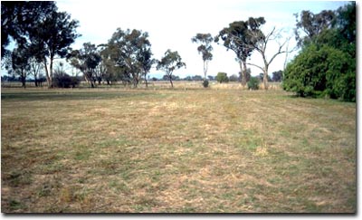 Example of a landscape in the Type A mapping unit. |
Typical Profile
| Surface | ||
| A | 0-22 cm | Loam, 12 to 37 cm thick; differentiated in the thicker horizons into a dark greyish brown (7.5YR5/4) or grey-brown A horizon, and a brown to dull yellowish brown (7.5YR6/6) weakly to moderately bleached subsurface (A2) horizon; usually sharply separated from: |
| Subsoil | ||
| B21 | 22-50 cm | Red-brown (5YR5/6 to 2.5YR5/8) clay; friable when moist; light buckshot irregularly present; grading into: |
| B22 | 50-75 cm | Variously mottled red-brown, brown, brownish yellow and grey friable clay; at depths varying from 67 to 85 cm sharply separated from: |
| B23 | 75-120 cm | Mainly grey and brown mottled, dense clay; scattered black inclusions; parting into small peds when moist; trace of calcium carbonate; light grey pockets up to 10 cm across irregularly present at the boundary with the horizon above. |
Soil Pit Site NE38 is an example of a soil that occurs in the Type A mapping unit.
Variations
Soils with red mottled B horizons have been included in the type.
© State of Victoria (Agriculture Victoria) 1996 - .

This work, Victorian Resources Online, is licensed under a Creative Commons Attribution 4.0 licence. You are free to re-use the work under that licence, on the condition that you credit the State of Victoria (Agriculture Victoria) as author, indicate if changes were made and comply with the other licence terms.
The licence does not apply to ‘branding’ or some ‘images or photographs’ that may be owned by third parties. We ask you to seek prior approval to use images using the VRO feedback form. Access to higher quality images can also be provided on request.
This page was last updated on .