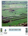
Managing Dryland Salinity with Vegetation in North East Victoria
This document summaries the groundwater processes in specific sub-catchments across the North East. In association with these processes guidelines are provided on how vegetation might be used to manage recharge and discharge. Section six contains general information on the vegetation options such as cropping, pastures and trees.
Published July 2000, 64 pages
 (PDF 1.37MB) (PDF 1.37MB) | |
Groundwater Monitoring Summary - Year 2000
This brochure summaries the groundwater monitoring program occurring across the North East Catchment Management Authority Region. Selected hydrographs from key bores are included in the centre of the brochure. Information on trends and the impact of climate variation on trends is also included.
Published 2000, A3 brochure
 (PDF 753KB) (PDF 753KB) | |
North East Salinity Strategy, Surface Water Salinity, Ovens Catchments
This is a report which presents the findings of 1999 surface water monitoring in the Ovens River, Black Dog Creek and Indigo Creek. Sections of this report include information on catchment characteristics, flow and salinity statistics.
Published August 2000, Pages 34
See Below for 2001 document.
 (PDF 395KB) (PDF 395KB) | |
North-East Salinity Strategy Surface Water Salinity Monitoring, Ovens Catchments - 2000
This is a report which presents the findings of 2000 surface water monitoring in the Ovens River, Black Dog Creek, Three Mile Creek and Indigo Creek. Sections of this report include information on catchment characteristics, flow and salinity statistics
Published October 2001, 32 pages (in two parts)
 (PDF 1.45MB) (PDF 1.45MB)  (PDF 518KB) (PDF 518KB) | |
North-East Salinity Strategy Surface Water Salinity Monitoring, Ovens Catchments - 2001
This is a report which presents the findings of 2001 surface water monitoring in the Ovens River, Black Dog Creek, Three Mile Creek and Indigo Creek. Sections of this report include information on catchment characteristics, flow and salinity statistics.
Published December 2002, pages 35 (in two parts):
 (PDF 560KB) (PDF 560KB)  (PDF1.3MB) (PDF1.3MB)
| |
North-East Salinity Strategy Surface Water Salinity Monitoring, Ovens Catchments - 2002
This is a report which presents the findings of 2002 surface water monitoring in the Ovens River, Black Dog Creek, Three Mile Creek and Indigo Creek. Sections of this report include information on catchment characteristics, flow and salinity statistics
Published May 2005, 22 pages
 (PDF 606KB) (PDF 606KB) | |
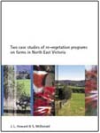
Two case studies of re-vegetation programs on farms in North East Victoria
This document presents case studies of revegetation in the Carboor and Springhurst areas. Topics covered include changes in vegetation cover, site management, benefits of revegetation and comments by the landholders involved.
Published August 2002, pages 21
 (PDF 866KB) (PDF 866KB) | |
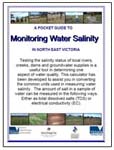
A Pocket Guide to Monitoring Water Salinity in North East Victoria
Designed to be pocket size, this guide should be kept in the glove box of the ute or somewhere for easy and quick reference. The guide contains information on salinity tolerance levels, salinity levels in local creeks, conversion of common salinity units and a table to record your readings.
Published September 2002, Pages A4 (when printed fold into four - like a card)
 (PDF 82KB) (PDF 82KB) | |
Assessment of the impact of groundwater pumping at Everton Upper.
This is a report which presents the findings of a groundwater pumping trial which was undertaken at a saline discharge site at Everton Upper between February 2002 and May 2003.
Published June 2004, 30 pages
 (PDF 315KB) (PDF 315KB) | |
Tree Decline: A North East Perspective.
This is a report which presents the findings of research into changes in vegetation cover over a 29 year period. The research was undertaken on two properties in the Springhurst area and looks at the extent of change as well as the causes. The research identified large decreases in cover and identifies the potential of on-going losses.
Published June 2003 (in three parts)
 (PDF 469KB) (PDF 469KB)  (PDF 464KB) (PDF 464KB) (PDF 1.1MB) (PDF 1.1MB) | |

