
Land Degradation
|
This study undertook a broad analysis of the susceptibility of the region to four land degradation processes: | 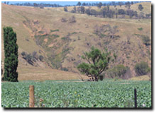 Erosion in Omeo valley |
The land degradation analysis has been undertaken for the freehold land areas that were included as a part of this NELRA project. The analysis indicates that there are significant areas at risk from land and water degradation in the NECMA region. Table 8 provides a breakdown of the area (ha) at high risk of land and water degradation hazards.
In the NECMA region, a range of soil-landform units are prone to land and water degradation. As this region is bound by the Great Dividing Range and contains the highest elevation landforms in Victoria, the primary process which influences the degradation risk is gravity. Primarily the steeper slopes are subject to mass movement and landslip while those colluvial sediments predominantly derived from sandstones and siltstones are prone to gully and tunnel erosion. Sheet and rill erosion occurs primarily at the base of the steeper slopes in the valleys and start of the riverine plains, whereas wind erosion occurs primarily on the plains to the north-west of the study area with the lighter subalpine soils also potentially vulnerable.
Table 8 Susceptibility to land degradation (ha and %) on freehold * land in the NECMA region
Hazard | High and Very High | Moderate | Low and Very Low | |||
ha | % | ha | % | ha | % | |
| Mass Movement | 38 437 | 4.8 | 326 737 | 41.2 | 427 902 | 54.0 |
| Gully and tunnel erosion | 18 672 | 2.3 | 713 803 | 90.0 | 60 600 | 7.7 |
| Sheet and rill erosion | 56 774 | 7.1 | 491 568 | 62.0 | 244 734 | 30.9 |
| Wind Erosion | 152 346 | 19.2 | 444 326 | 56.0 | 196 405 | 24.8 |
The terms hazard and susceptibility are often used interchangeably, causing much confusion. Susceptibility of land to a specific deterioration process is defined here as a constant inherent feature, but the hazard changes depending upon the level of management and the type of land use.
Soil erosion and sedimentation is considered to be a major problem and can reduce the productivity of agricultural land. Sediment is the greatest pollutant of the world’s surface waters as it degrades water quality and may carry adsorbed polluting chemicals (Robinson 1971). Furthermore most soils have very slow rates of formation and should be considered as a non-renewable resource thus the management of these soils is a very important consideration. It is therefore prudent to assess the risk, or susceptibility, of land to various forms of degradation.
As a result susceptibility to erosion maps have been generated for each of the four erosion themes discussed below. A three class rating of high, medium and low susceptibility has been developed based upon criteria outlined in the relevant section.
© State of Victoria (Agriculture Victoria) 1996 - 2025.

This work, Victorian Resources Online, is licensed under a Creative Commons Attribution 4.0 licence. You are free to re-use the work under that licence, on the condition that you credit the State of Victoria (Agriculture Victoria) as author, indicate if changes were made and comply with the other licence terms.
The licence does not apply to ‘branding’ or some ‘images or photographs’ that may be owned by third parties. We ask you to seek prior approval to use images using the VRO feedback form. Access to higher quality images can also be provided on request.
This page was last updated on 25/01/2019.