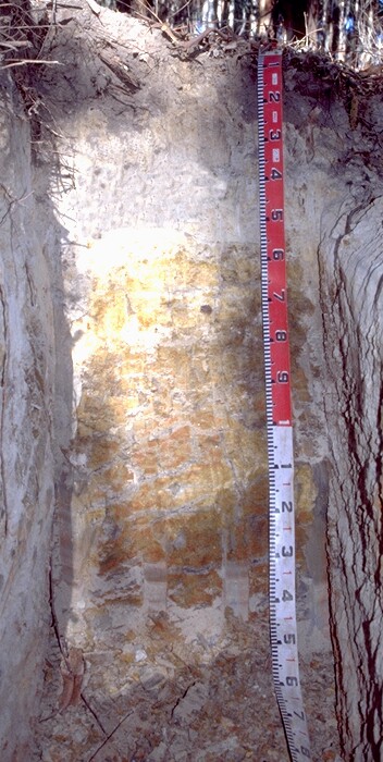
EGS250
Location: Tostaree
Australian Soil Classification: Grey CHROMOSOL
Northcote Factual Key: Dy5.41
Map Unit: Waygara
Previous Site Name: EG250, CFTT01
General Landscape Description: Undulating plain.
Site description: 4% slope to east
Land Use: Plantation forest.
Native vegetation: Lowland forest.
Geology: Tertiary sediments
Soil Profile Morphology:
Surface Soil
| A1 | 0 – 15 cm | Very dark greyish brown (10YR3/2) loamy fine sand; weak coarse granular structure; very weak consistence moderately moist; clear and wavy transition to:
|  EG250 Profile (was also called CFTT01) |
| A2 | 15 – 50 cm | Pale brown (10YR6/3), conspicuously bleached (10YR7/2 dry); loamy fine sand; massive; very weak consistence dry; clear and wavy transition to:
| |
| A3 | 50-55/65 cm | Greyish brown (10YR5/2), many, coarse, distinct, yellowish brown (10YR5/6) and strong brown (7.5YR4/6) mottles, sandy clay loam; massive; weak consistence dry; abrupt and wavy transition to: | |
| Subsoil | |||
| B21 | 55/65-110 cm | Light brownish grey (10YR6/2), many, very coarse, prominent strong brown (7.5YR5/6) mottles, light medium clay; moderate coarse polyhedral structure, parting to moderate medium polyhedral structure; strong consistence moist; diffuse and smooth transition to:
| |
| B22 | 110-150 cm | Grey (10YR5/1), many, very coarse, prominent strong brown (7.5YR5/6) and red (2.5YR4/6) mottles; light medium clay; moderate very coarse polyhedral structure, parting to moderate coarse polyhedral structure; strong consistence moist; veins of similarly coloured sandy clay appear with depth. |
Profile Described by: Ian Sargeant and Justin Wong (June 1999).


