EGS235
Location: Bendoc North
Australian Soil Classification: Yellow KUROSOL
Map Unit: Bendoc (Component 1)
Previous Site Name: EG235
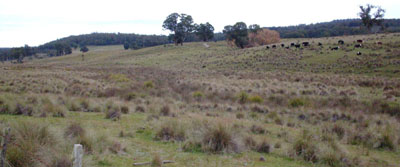
General Landscape Description: Undulating low hills
Site Description: Lower hill-slope, 5% slope to north-west
Land Use: Grazing
Native Vegetation: Montane grassy woodland
Geology: Ordovician sediments

Soil Profile Morphology:
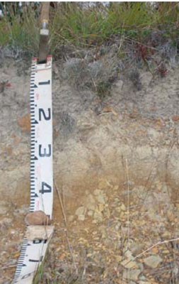
Surface Soil
| A1 | 0 – 15 cm | Dark grey (10YR4/1); fine sandy loam; firm dry; weak medium polyhedral structure; pH 5.1; clear change to: |  |
A2 | 15 – 35 cm | Greyish brown (10YR5/2) conspicuously bleached (10YR7/2d); fine sandy loam; massive; very firm consistence dry; common angular tabular pebbles; clear change to: | |
Subsoil | |||
B2 | 35 – 45+ cm | Yellowish brown (10YR5/4); medium clay. |
Chemical and Physical Analysis:
Horizon | Horizon Depth (cm) | pH (water) | pH (CaCl2) | EC dS/m | Exchangeable Acididty meq/100g | Exchangeable Cations | |||
Ca | Mg | K | Na | ||||||
meq/100g | |||||||||
A1 | 0-20 | 5.1 | 4.3 | <0.05 | 9.4 | 1 | 1.4 | 0.12 | 0.14 |
Profile Described By: Ian Sargeant, 2011.


