Dargo (Symbol: Do)
Geology
Palaeozoic granites, some coarse grained metamorphic sediments; deeply weathered.
Landform
Enclosed rolling low hills, with steep hills often adjoining stream lines. Elevation range in this area 50 - 500 m with local relief 30 – 90 m, and slope gradients <32 %. Broad concave drainage lines with slope gradients generally less than 5 %.
The Dargo map unit may be subdivided into four components: moderate to gentle slopes are the most extensive component, generally without rock outcrops. Areas comprising open depressions and steep slopes generally with rock outcrop are less extensive.

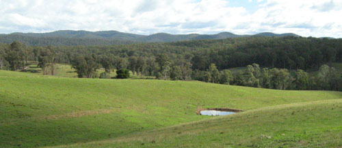
The granitic soils in the foreground have been mapped into the Dargo unit. Photo was taken from the Orbost Buchan Road.
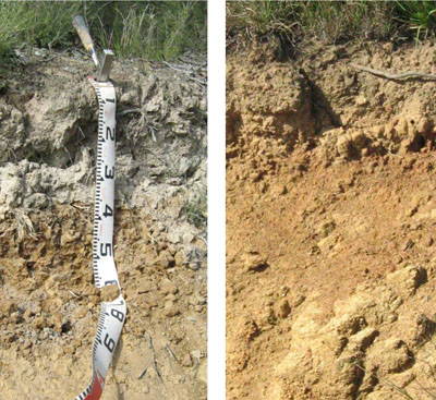
| Soils These soils are described in detail in the Soils and landforms of the Omeo/Benambra and Tambo valley soil manual. These soils have developed over deeply weathered granite or on colluvium derived from granite. Most of the soils on hill slopes are moderately deep (0.8 – 1.5 m) with deeper soils in the broad drainage lines. On the moderate to gentle slopes the surface soils are generally slightly to moderately acidic sandy loams, characteristically coarse sandy; with sandy clay to medium clay subsoils generally occurring about 25 – 50 cm. This change in texture is generally sharp to clear but may be gradual. The surface soils are usually dark brown with a paler subsurface soil. Subsoil colours are mostly reddish brown but may also be yellow brown. Soil analysis No soil analyses were carried out for this report, but further information is available in the report titled ‘Soils and landforms of the Omeo/Benambra and Tambo valley region’. Native vegetation Shrubby dry forest. |  Two soil profiles on granite on the Buchan-Orbost Road, south east of Buchan. |


