Buchan South (Symbol: BS)
Geology
Late Tertiary (Neogene) alluvial sediments. These sediments were deposited following the uplift and subsequent erosion of the Eastern Highlands, an event which continued up to the Late Tertiary Period. Sediments of the same age also occur in the broad coastal area extending from Stockdale in the west to Tamboon in the east. These sediments were probably more extensive in the geological past, but here much has since been eroded.
Landform
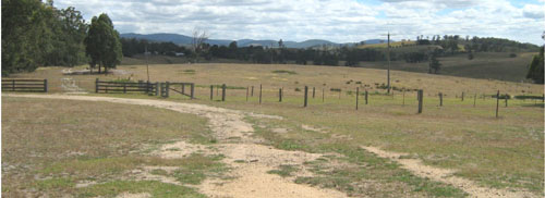
The rolling low hills of Buchan South Map Unit have an elevation range of about 150 to 300 m and a relief range of about 30 to 90 m. Slopes are generally less than 10%. Because of the limited extent of this map unit, no separate components are identified.

Rolling low hills south of Buchan.
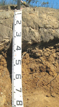
| Native vegetation Shrubby dry forest Soils The surface soils are mostly greyish brown in colour with surface textures varying from gravelly loams to fine sandy loams. No soil pits were dug on this map unit. Auger holes and roadside exposures show the surface soils are dull brown fine sandy loams to coarse sandy loams. The similarly textured subsurface soils are paler and usually bleached, generally light yellowish brown when moist and very pale brown when dry. Between 35 to 50 cm there is a sharp increase in texture to brown light to medium clays. Limited observations show the surface soils and the subsoils are strongly to moderately acid. Similar soils on the foothills further south are also strongly to moderately acid. Land use Apart from remnants of original vegetation, the land has been cleared and is mostly used for grazing. In the past, some extractive industry took place, mainly gravel and sand extraction. The sub-surfaces of the more gravelly soils within this map unit tend to set very hard when dry. |  Soil exposure on the Buchan South road |


