
Soil/Landform Unit 84
Landform Unit Description
Page top
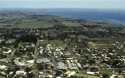 Northern edge of the plateau scarp west of Drysdale |
0.05% of CMA region This single narrow scarp and capping unit is exposed within the Neogene plateau (Unit 77) due to dissection, and forms the south-western boundary of the plateau onto the alluvial plains and flats (Unit 200) associated with the Barwon River lake system. There is arguably also a scarp face along all of the western edge and much of the eastern edge of the plateaux (Unit 77). There are two components based on lithology. The soils are red and brown (often ferruginous) texture contrast soils (Chromosols) associated with ferruginised sand, and shallow dark calcareous medium texture soils on limestone on the mid and/or lower slopes. The texture contrast soils are susceptible to sheet and rill erosion and surface nutrient decline, while the calcareous soils are mainly susceptible to sheet erosion (friable) on the steeper slopes. Land use tends to be grazing and conservation. | 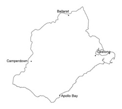 |
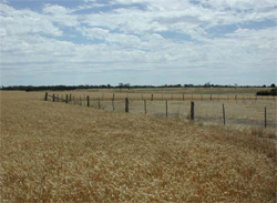 Drainge depression associated with plains near Marcus Hill | 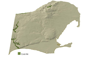 |
 |
Component | 1 | 2 |
Proportion of soil-landform unit | 40% | 60% |
| CLIMATE Rainfall (mm) | Annual: 590 | |
| Temperature (oC) | Minimum 10, Maximum 19 | |
| Precipitation less than potential evapotranspiration | October-April | |
| GEOLOGY Age and lithology | Neogene marine marl and calcarenite, fluvio-marine sand, Recent clay, sand and gravel and Paleogene tholeiites and pryoclastics | |
| Geomorphology | ||
| LANDUSE | Uncleared: Nature conservation; passive and active recreation Cleared areas: Seep and beef cattle grazging; regional development | |
| TOPOGRAPHY Landscape | Low hills | |
| Elevation range (m) | 6-85 | |
| Local relief (m) | 40 | |
| Drainage pattern | Dendritic | |
| Drainage density (km/km2) | 1.7 | |
| Landform | Low scarp | |
| Landform element | Upper and mid slope | Mid and lower slope |
| Slope and range (%) | 10 (3-30) | 10 (3-30) |
| Slope shape | Concave | Straight, concave |
| NATIVE VEGETATION Ecological Vegetation Class | Grassy Woodland (5.5%), Calcarenite Dune Woodland (2.1%), Damp sands Herb-rich Woodland (1.0%), Other (1.9%) | |
| SOIL Parent material | Ferruginised sand, silt marl, minor limestone | Silt, marl, minor limestone, ferruginised sand |
| Description (Corangamite Soil Group) | ||
| Soil type sites | CLRA32, CLRA33 | |
| Surface texture | Caorse sandy loam, clay loam | Clay loam, coarse sandy loam |
| Permeability | Moderate | High |
| Depth (m) | <1 | <1 |
| LAND CHARACTERISTICS, POTENTIAL AND LIMITATIONS | Large texture contrast between surface soil and subsoil, low nutrient holding capacity and water holding capacity in surface soils, much higher in subsoil. Light surface soil susceptible to nutrient decline, sheet and rill erosionand wind erosion. Restricted drainage where slow site drainage. Site drainage generally very rapid. | Gradational, shallow, strongly structured soil. Low water holding capacity (shallow) but high nutrient holding capacity. Site drainage is very rapid, less at slope base. Susceptibility to sheet erosion on steep slopes. |
© State of Victoria (Agriculture Victoria) 1996 - 2025.

This work, Victorian Resources Online, is licensed under a Creative Commons Attribution 4.0 licence. You are free to re-use the work under that licence, on the condition that you credit the State of Victoria (Agriculture Victoria) as author, indicate if changes were made and comply with the other licence terms.
The licence does not apply to ‘branding’ or some ‘images or photographs’ that may be owned by third parties. We ask you to seek prior approval to use images using the VRO feedback form. Access to higher quality images can also be provided on request.
This page was last updated on 23/03/2020.