Soil/Landform Unit 177
Landform Unit Description
Page top
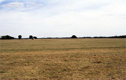 Undulating plains near Nullawarre |
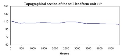
0.08% of CMA region This unit of gently undulating plains comprises mounds and shallow depressions known as blow outs in the Nullawarre area. Occurring on the western boundary of the catchment, this unit forms one of many sedimentary landforms within the Western Plains of Victoria. This unit consists of plains with minor dissection where the Neogene sandy sediments cap Neogene limestone, which may explain the limited surface drainage expression. The soils tend to be acidic mottled texture contrast (Kurosols) soils on the mounds or very slight rises, with acidic mottled texture contrast soils with sporadic bleached subsurface horizons occurring on the flats and shallow depressions (blow-outs between the mounds). Unbleached equivalents occur on the crests with the occasional gradational soil (Dermosol). Remnant vegetation includes the Damp Heathland/Damp Heathy Woodland Mosaic and Herb-rich Foothill Forest classes. The high annual rainfall explains most of the soil acidity (due to leaching). Dairying is the major land use of this unit. Surface and subsurface soil nutrient decline and local waterlogging are susceptibilities of this unit. | 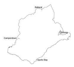 |
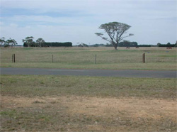 The plains are mainly used for grazing by diary and beef cattle | 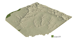 |
 |
Component | 1 | 2 | 3 |
Proportion of soil-landform unit | 20% | 60% | 20% |
| CLIMATE Rainfall (mm) | Annual: 910 | ||
| Temperature (oC) | Minimum 9, Maximum 18 | ||
| Precipitation less than potential evapotranspiration | November–March | ||
| GEOLOGY Age and lithology | Neogene fluvial-marine sediments, minor marl, calcarenite | ||
| Geomorphology | |||
| LANDUSE | Uncleared areas: Hardwood forestry for sawlogs, posts and poles; water supply; nature conservation Cleared areas: Dairy farming; beef cattle and sheep grazing; cropping (cereal and horticulture); water supply; softwood plantations | ||
| TOPOGRAPHY Landscape | Gently undulating plains | ||
| Elevation range (m) | 31–124 | ||
| Local relief (m) | 4 | ||
| Drainage pattern | Dendritic | ||
| Drainage density (km/km2) | 0.4 | ||
| Landform | Undulating plains with very slight rises (mounds) | ||
| Landform element | Mound crests | Mound slopes | Flats and sinkholes |
| Slope and range (%) | 1 (0–3) | 3 (1–8) | 0 |
| Slope shape | Straight | Convex | Straight |
| NATIVE VEGETATION Ecological Vegetation Class | Damp Heathland/Damp Heathy Woodland Mosaic (2.3%), Herb-rich Foothill Forest (0.5%) | ||
| SOIL Parent material | Sand, silt and clay | Sand, silt and clay | Marl, calcarenite, sand, silt and clay |
| Description (Corangamite Soil Group) | Acidic mottled brown, grey or yellow texture contrast soils (15) | Acidic mottled brown, grey or yellow texture contrast soils (15) | |
| Soil type sites | |||
| Surface texture | Fine sandy loam | Fine sandy loam | Fine sandy loam |
| Permeability | Moderate | Moderate | High |
| Depth (m) | <1.5 | < 2 | < 2 |
| LAND CHARACTERISTICS, POTENTIAL AND LIMITATIONS | Texture contrast, occasionally gradational. Heavy clay subsoil. Acidic upper soil. Low nutrient holding capcity in upper soil (depending on organic matter content), higher in subsoil. Surface permeability is moderate to high but low in subsoil. Site drainage is well drained (water shedding). | Texture contrast, occasionally gradational. Heavy clay subsoil. Acidic upper soil. Low nutrient holding capcity in upper soil (depending on organic matter content), higher in subsoil. Surface permeability is moderate to high but low in subsoil. Site drainage is moderately to imperfectly drained (water shedding and receiving) | Texture contrast, occasionally gradational. Heavy clay subsoil. Acidic upper soil. Low nutrient holding capcity in upper soil (depending on organic matter content), higher in subsoil. Surface permeability moderate to high, but low to moderate in subsoil. Site drainage imperfectly to poorly drained (water receiving). |


