23 Red, brown and black strongly acidic and neutral texture contrast soils on Neogene limestone
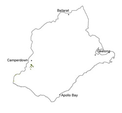
| These soils occur in the south-west of the CMA where dissection of the landscape has exposed limestone deposits (Port Campbell Limestone). This area has a higher rainfall than the basalt plains to the north and north-east, which explains the leaching of cations (calcium in particular) from these soils. These soils are strongly and finely structured, apart from the occasional sandier surface. The dark very fine sandy clay loam surface soil (10 cm) grades into a slightly paler light clay subsurface horizon (to 20–25 cm), which clearly overlies a strongly acidic brown (may be mottled at lower depths) or dark red medium or medium to heavy clay before sharply overlying weathered parent material or hard rock (limestone) at 75 to 100 cm. Notable features include: texture contrast despite high clay content of surface soils, high clay content compared with field assessment, fine structure throughout, acidic surface and upper subsoil horizons, calcareous lower often vertic subsoil, and high nutrient capacity despite low pH. |  |
Soil Sites
Site Code | Soil-landform unit | Component | ASC | FK | 1:100 000 mapsheet |
| Simple slope | Haplic, Eutrophic, Brown Kurosol | Dy3.12 | T7421 - Mortlake | ||
| Upper slope | Haplic, Eutrophic, Red Kurosol | Dr2.11 | T7421 - Mortlake | ||
| Crest | Mottled, Eutrophic, Brown Chromosol | Db2.31 | T7521 - Corangamite |


