
OTR499
|
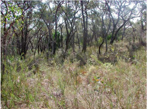
| OTR499 | Bleached-Sodic, Eutrophic, Black Kurosol | |
| Anglesea | |||
| Hills | |||
| Palaeogene Demons Bluff Formation | |||
| Hillslope - mid slope | |||
| 0% | |||
| - | |||
Horizon | Depth (cm) | Description | ||
A1 | 0–10 | Black (10YR2/1); loamy fine sand; apedal single grain structure; gradual boundary to: | ||
A2 | 10–30 | Grey (10YR5/1); loamy fine sand; apedal single grain structure; clear wavy boundary to: | ||
B21 | 30–50 | Very dark greyish brown (10YR3/2); sandy clay loam; weak coarse (40 mm) subangular blocky structure; organic stains on ped faces; diffuse boundary to: | ||
B22 | 50–120 | Dark yellowish brown (10YR4/4); sandy clay loam; coarse (40 mm) subangular blocky structure; clay skin cutans; diffuse boundary to: | ||
C | 120+ | Yellowish brown (10YR5/6); sandy clay; apedal massive structure. | ||
| Management considerations | ||||
| The sandy topsoil generally has poor plant water and nutrient holding capacities and due to the low level of bonding between soil particles are particularly prone to wind erosion where land is cleared. Sheet and rill erosion (depending on organic matter content and vegetative cover) may also be an issue. The soils are possibly hydrophobic (in conjunction with organic coatings) when dry, taking time to reabsorb moisture. Sandy topsoils do however drain rapidly and maintenance of a vegetative cover is important. The acidic soils restrict the uptake of certain nutrients as well as intolerance for some plant species (due in part to the increasing mobilisation of aluminium and manganese). Sodic subsoils usually have poor structure (generally as coarse domed columns). The poor structure results in dispersion (and subsequent clogging of pores), restricting water and gas movement through the subsoil. These soils are hardsetting and have limited opportunity for cultivation without further damage to soil structure. Deficiencies of calcium, potassium and molybdenum are likely. | ||||
Analytical data
Site OTR499 | Sample depth | pH | EC | NaCl | Ex Ca | Ex Mg | Ex K | Ex Na | Ex Al | Ex acidity | FC (-10kPa) | PWP (-150kPa) | KS | FS | Z | C | |
Horizon | cm | H2O | CaCl2 | dS/m | % | cmolc/kg | cmolc/kg | cmolc/kg | cmolc/kg | mg/kg | cmolc/kg | % | % | % | % | % | % |
A1 | 0-10 | 4.7 | N/R | 0.052 | N/R | 2.5 | 0.9 | 0.1 | 0.04 | N/R | N/R | N/R | N/R | 1 | 83 | 6 | 7 |
A2 | 10-20 | 4.6 | N/R | 0.037 | N/R | 0.9 | 0.2 | 0.07 | 0.01 | N/R | N/R | N/R | N/R | 1 | 84 | 10 | 6 |
A2 | 20-30 | 4.9 | N/R | 0.021 | N/R | 0.5 | 0.3 | 0.03 | 0.01 | N/R | N/R | N/R | N/R | <1 | 90 | 3 | 7 |
B21 | 40-50 | 5.3 | N/R | 0.060 | N/R | 1.2 | 2.5 | 0.2 | 0.2 | N/R | N/R | N/R | N/R | 1 | 69 | 5 | 22 |
B22 | 110-120 | 5.2 | N/R | 0.258 | N/R | 0.9 | 3.3 | 0.1 | 0.8 | N/R | N/R | N/R | N/R | <1 | 65 | 4 | 29 |
© State of Victoria (Agriculture Victoria) 1996 - 2025.

This work, Victorian Resources Online, is licensed under a Creative Commons Attribution 4.0 licence. You are free to re-use the work under that licence, on the condition that you credit the State of Victoria (Agriculture Victoria) as author, indicate if changes were made and comply with the other licence terms.
The licence does not apply to ‘branding’ or some ‘images or photographs’ that may be owned by third parties. We ask you to seek prior approval to use images using the VRO feedback form. Access to higher quality images can also be provided on request.
This page was last updated on 23/03/2020.