Soil/Landform Unit 169
Landform Unit Description
Page top
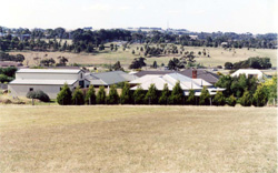 Fertile and friable soils of the hillslopes are undergoing large land use changes as residential development further inhabits these slopes |
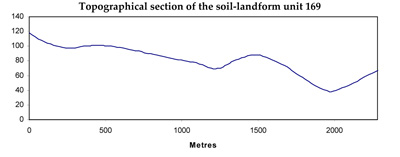
0.03% of CMA region Located at Waurn Ponds, these sedimentary undulating low hills are derived from Paleogene marine clay (Jan Juc Formation). These marine clays are marls and calcarenites that are further exposed near Torquay in the major sea cliffs. As part of the Western Plains, this landscape serves as a stepping stone from the Barrabool Hills down to Geelong. The soils on these hillslopes are friable black gradational soils with good soil fertility and water holding capacity. Grassy Woodland is the major remnant vegetation, however the rapid rate of residential development in this area makes this vegetation even more vulnerable. While previously these fertile hillslopes and footslopes may have been used for cereal production (or potentially horticulture), little of this land remains for agricultural production. | 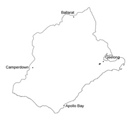 |
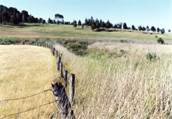 Friable black gradational soils of the hillslopes are also found in the neighbouring alluvial Unit 192 | 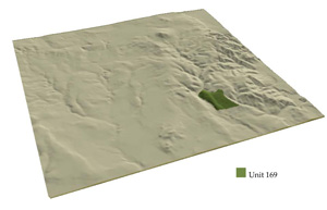 |
 |
Component | 1 | 2 | 3 |
Proportion of soil-landform unit | 20% | 30% | 50% |
| CLIMATE Rainfall (mm) | Annual: 620 | ||
| Temperature (oC) | Minimum 10, Maximum 19 | ||
| Precipitation less than potential evapotranspiration | October-April | ||
| GEOLOGY Age and lithology | Paleogene marine clay, Recent clay, sand and gravel | ||
| Geomorphology | |||
| LANDUSE | Uncleared: Nature conservation Cleared: Residential development | ||
| TOPOGRAPHY Landscape | Undulating low hills | ||
| Elevation range (m) | 39-120 | ||
| Local relief (m) | 75 | ||
| Drainage pattern | Dendritic | ||
| Drainage density (km/km2) | 0.9 | ||
| Landform | Low hills | ||
| Landform element | Gentle crests, upper slopes | Mid slopes | Lower slopes |
| Slope and range (%) | 4 (2-4) | 1 (0-3) | 0 (0-1) |
| Slope shape | Convex | Straight | Straight |
| NATIVE VEGETATION Ecological Vegetation Class | Grassy Woodland (2.3%) | ||
| SOIL Parent material | Clay, silt and sand | Clay, silt and sand | Clay, silt and sand |
| Description (Corangamite Soil Group) | Alkaline friable black gradational soils (29) | Alkaline friable black gradational soils (29) | Alkaline friable black gradational soils (29) |
| Soil type sites | CLRA13, SW40 | SW40 | |
| Surface texture | Clay loam | Clay loam | Clay loam |
| Permeability | High to moderate | Moderate | Moderate |
| Depth (m) | <2 | <2 | >2 |
| LAND CHARACTERISTICS, POTENTIAL AND LIMITATIONS | Gradational. Friable. Moderate to high water holding capacity and nutrient holding capacity. Strongly structured, fine. Moderately rapid site drainage. Moderate compaction susceptibility when moist. Alkaline and maybe calcareous with depth. | Gradational, occasional texture contrast. Friable. Moderate to high water holding capacity and nutrient holding capacity. Strongly structured, fine. Moderate site drainage. Moderate compaction susceptibility when moist. Alkaline and maybe calcareous with depth, occasionally sodic. | Gradational, occasionaly texture contrast. Friable. Moderate to high water holding capacity, high nutrient holding capacity. Strongly structured, fine. Slow site drainage. Moderate compaction susceptibility when moist. Alkaline and may be calcareous with depth, occasionally sodic. |


