Soil/Landform Unit 153
Landform Unit Description
Page top
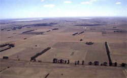 Looking orth over swamps, lunettes and plains of this unit |
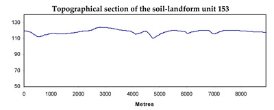
1.26% of CMA region This unit consists of gently undulating plains, swamps and associated minor lunettes that occur between Cressy and Colac. Located within the volcanic Western Plains, the relief of this unit is subdued having a masked affect upon agricultural performance and land versatility. This unit has a number of components, some (such as the low rises and undulating plain) are erosional landforms while others (such as the swamps, flats and lunettes) are depositional. The unit is adjacent to lakes and basaltic (stony) rises and forms a north-south corridor between Cressy and Lake Colac. Remnant vegetation of this unit is Plains Grassy Woodland. The soils are black strongly sodic texture contrast soils on the plains (coarse structure, hardsetting) with black and red cracking self-mulching soils on the lunettes, and black and grey cracking soils in the swamps. Land use is generally grazing, with the capability of the unit varying with component composition. The shallower soils on rock and strongly structured soils on the lunettes provide more use throughout the year than the wetter flats. | 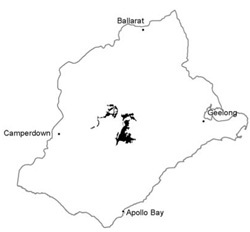 |
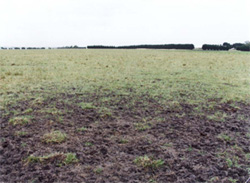 Soils are prone to pugging by cattle when saturated | 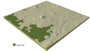 |
 | 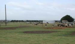 Dairy farming and feed lots of Friesian heifers on the plains and swamps |
Component | 1 | 2 | 3 | 4 | 5 |
Proportion of soil-landform unit | 2% | 3% | 10% | 60% | 25% |
| CLIMATE Rainfall (mm) | Annual: 600 | ||||
| Temperature (oC) | Minimum 8, Maximum 19 | ||||
| Precipitation less than potential evapotranspiration | October-March | ||||
| GEOLOGY Age and lithology | |||||
| Geomorphology | |||||
| LANDUSE | Uncleared: Nature conservation; water supply; active and passive recreation Cleared: Cropping; beef cattle and sheep grazing; dairy; regional development | ||||
| TOPOGRAPHY Landscape | Gently undulating plains with swamps, lakes and lunettes | ||||
| Elevation range (m) | 112-139 | ||||
| Local relief (m) | 10 | ||||
| Drainage pattern | Centripetal | ||||
| Drainage density (km/km2) | 1.3 | ||||
| Landform | Low rises and hillocks | Lunettes | Plains with minor drainage depressions | Swamps and broad depressions | |
| Landform element | Crests and upper slopes | Mid and lower slopes | Lunettes | Plains | Swamps |
| Slope and range (%) | 3 (1-6) | 5 (3-10) | 2 (1-5) | 1 (0-3) | 2 (1-5) |
| Slope shape | Convex | Concave | Convex | Straight | Concave |
| NATIVE VEGETATION Ecological Vegetation Class | Plains Grassy Woodland (1%) | ||||
| SOIL Parent material | In situ basalt | In situ basalt | Aeolian deposits | In situ basalt and associated colluvium | Alluvial clay, silt and sand |
| Description (Corangamite Soil Group) | Friable red gradational soils (40) and alkaline red self-mulching clays and some black self-mulching clays (39) | Alkaline black and grey self-mulching clays (9) | Alkaline mottled black texture contrast soils, some not mottled (35) | Alkaline grey cracking clays (31) | |
| `Soil type sites | |||||
| Surface texture | Clay loam | Light clay | Medium clay | Fine sandy clay loam | Medium clay |
| Permeability | Moderate to high | Moderate | Moderate | Low | Very low |
| Depth (m) | <1.5 | <2 | >2 | <2 | >2 |
| LAND CHARACTERISTICS, POTENTIAL AND LIMITATIONS | Friable soils, some expansive clays. Gradational or uniform texture change with depth. Moderate to high permeability, moderately rapid site drainage. Moderate to high nutreient capacity. | Friable but expansive clays and other friable soils. Uniform or gradational texture change with depth. Moderate permeability, moderately rapid site drainage. | Friable but expansive clays, calcareous and often sodic at depth. high nutrient capacity. | Texture contrast, possible waterlogging and compaction. | High seasonal watertable leads to soil compaction. High organic matter content, high clay content and expansive clays. |


