Your gateway to a wide range of natural resources information and associated maps

Victorian Resources Online

Geelong Mapsheet - Soil Pit Sites

Back to: Corangamite Region Mapsheet Grid

Geelong Mapsheet - Soil Pit Sites (PDF 1169KB)
The high resolution PDF file provided on this page can be viewed using the free Adobe PDF reader and this software can be installed from the Adobe website (external link). This PDF is provided with a high level of detail and with the intent that it should be printed at a high resolution.

The Geelong mapsheet is clickable. Click on the respective soil pit for detailed information. The soil pits are also listed below and are clickable.
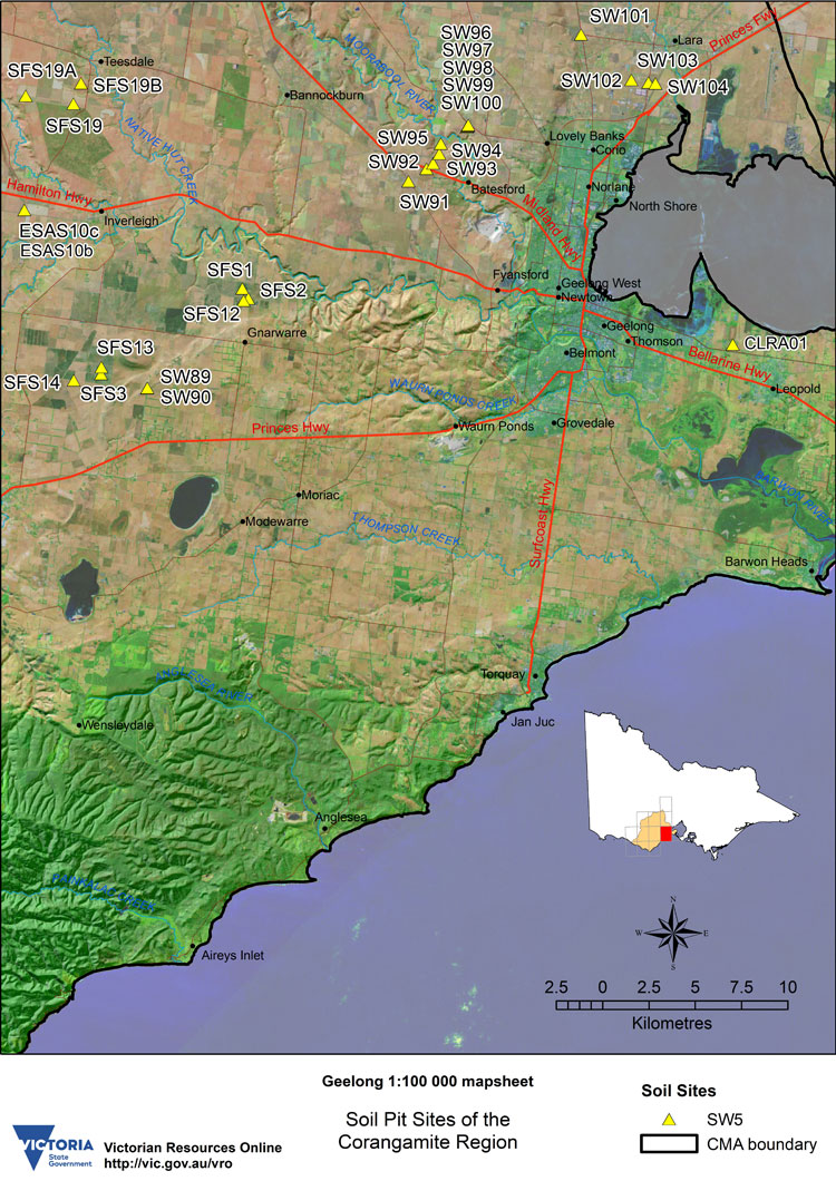

Geelong Soil Pit Map SFS1 SFS2 SFS3 SFS12 SFS13 SFS14 SFS19 SFS19a SFS19b ESAS10b ESAS10c SW89 SW90 SW91 SW92 SW92 SW93 label SW93 point SW94 label SW94 point SW95 SW95 point SW96 SW97 SW98 SW99 SW100 SW101 SW102 SW103 label SW103 point SW104 SW104 point


GEELONG Mapsheet - Soil Pit Sites

SW89SW90SW91SW92SW93SW94SW95SW96SW97SW98SW99SW100SW101SW102SW103SW104
SFS1SFS2SFS3SFS12SFS13SFS14SFS19SFS19aSFS19bESAS10bESAS10cCLRA01
OTR489OTR490OTR492OTR497OTR499OTR500OTR601OTR605OTR606
Page top