Soils of Victorian Grain Cropping Regions
Back to: Victorian Grains Soils
| There is a great diversity of soil types across Victoria’s grain cropping regions that reflect differences in parent material, topography, climate, landform processes and age (e.g. degree of weathering). These different soil types have a range of physical and chemical characteristics (e.g. structure, drainage, depth, pH, sodicity) that impact on management. The map presented here is a consistent and broad statewide overview that displays the dominant Soil Orders, according to the Australian Soil Classification (Isbell, 2002). The grain cropping areas are based on data from the Victorian Land Use Information System (VSIS) and may not include all cropped areas. Also, not all these soils are used for cropping. Although many of these soils are well suited, there are some that present significant limitations such as shallow depth, poor drainage, salinity or stoniness. Landscape qualities can also present constraints, e.g. steep slopes, accessibility. |
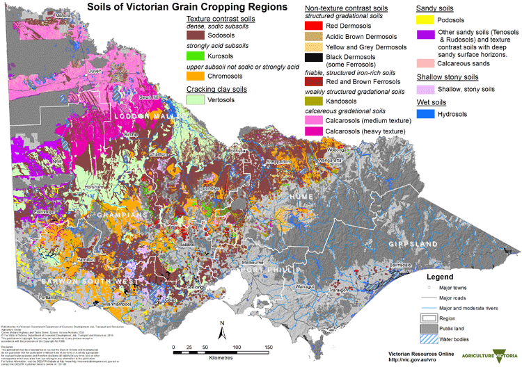
Regional map views are also provided.
For more detailed soil/landscape mapping and information about regional soils and landforms in particular areas please access these regional areas of the VRO website:
Mallee region
Wimmera region
North Central region
Goulburn Broken region
North East region
Corangamite region
Glenelg-Hopkins region
West Gippsland region
Also, the Soil and Land Survey Directory enables you to search for and access legacy soil and landscape survey reports based on a Local Government Area or catchment management region of interest.
Texture contrast soils
Texture contrast soils are widespread in all Victorian grain cropping regions and are the dominant cropping soil in much of central and southern Victoria. These soils are typified by a strong texture contrast between lighter textured surface (A) horizons and the heavier textured clay subsoil (B horizons). Texture contrast soils can be can be divided into three broad Soil Orders; Sodosols, Kurosols and Chromosols, based on key subsoil properties such as pH and sodicity that are important for management.
| Sodosols have subsoils that are not strongly acid (i.e. pH >5.5 in water) but are sodic and usually dense and coarsely structured. Red Sodosols (historically referred to as ‘red-brown earths’) occur extensively on the older alluvial plains in northern Victoria. In central Victoria, Red Sodosols are common on gentle hillslopes on older (Palaeozoic) sediments and may contain abundant gravel in the upper horizons. Red and Brown Sodosols typically occur in the Wimmera region associated with a wide range of landforms (from gently undulating plains and rises to undulating low hills). Black and Brown Sodosols more commonly occur in South West Victoria, associated with basalt plains and rises. In Gippsland, Yellow and Brown Sodosols are common on the plains and rises to the east of Traralgon where the rainfall is relatively lower. More detailed information about Sodosols in Victorian grain cropping regions |  |
| Kurosols have clay subsoils that are strongly acid (i.e. pH less than 5.5 in water). They are not a common soil used for grain cropping and mainly occur on hills in the relatively higher rainfall areas in central, south-west and north-east Victoria. More detailed information about Kurosols in Victorian grain cropping regions | 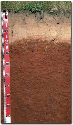 |
| Chromosols have clay subsoils that are not strongly acid (i.e. pH 5.5 or greater in water) and are non-sodic. These soils are common on the volcanic plains in South West Victoria, particularly west of Camperdown. They also occur in central and north-east Victoria. More detailed information about Chromosols in Victorian grain cropping regions. | 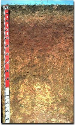 |
Cracking clay soils
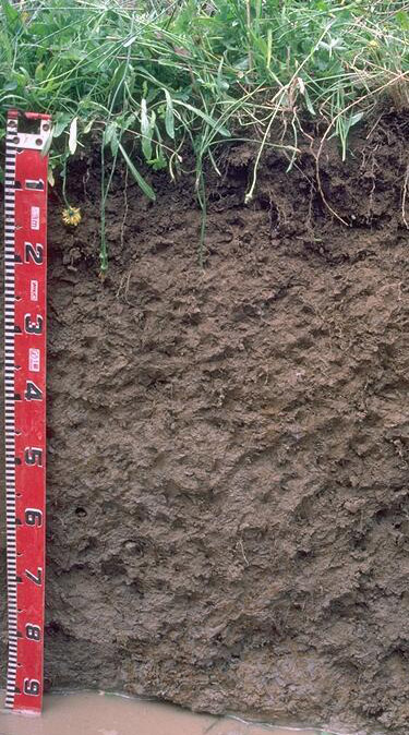
| Cracking clay soils are referred to as Vertosols using the Australian Soil Classification. They are clay soils that shrink and swell causing seasonal cracking as the soil dries out. Grey Vertosols are common in the northern Victorian riverine plain, particularly on large floodplains in the Murray and Loddon valleys. There are some small occurrences in south-west Victoria but are often difficult to map at this statewide overview level where they often occur as minor components in many of the landscapes. Vertosols are widespread in the Wimmera and southern Mallee regions, usually occurring on level to gently undulating gilgaied plains, and are a major soil utilised for grain cropping. They occur mainly on level to gently undulating plains, as well as on alluvium along creeks and rivers and lake bed deposits. More detailed information about Vertosols in Victorian grain cropping regions. |  |
Sandy soils
This broad group consists of a diverse range of soils that are mainly sandy (particularly in the upper 60 cm of the soil profile).
| Podosols are mainly sandy throughout with accumulations of organic materials and aluminium (with or without iron compounds), often referred to as “coffee rock”, in the subsoil. The are not a common soil and occur mostly in the far south-west. Calcareous sands are common in the Mallee region where they are associated with east-west trending dunes. They are calcareous throughout, with visible accumulations of calcium carbonate (lime), as soft or hard fragments, increasing with depth. Soils with thick sandy surface horizons overlying clay subsoils are also included in the sandy soils category. These soils are commonly found on sand sheets, low dunes and hill slopes in the Wimmera and southern Mallee regions and may occur in association with Podosols. They are characterised by thick sandy surface horizons (60 cm or greater in depth) overlying a clay subsoil (that is often sodic). More detailed information about Sandy Soils in Victorian grain cropping regions. |  |
Non texture contrast soils
Dermosols are non-texture contrast earthy soils, that have moderately deep and reasonably well structured subsoils. They are not a widespread soil in Victorian grain cropping regions.
| Well-structured Black Dermosols are common on volcanic ash deposits in South West Victoria. Brown and Yellow Dermosols are common on plains and lower slopes in the Rutherglen region. More detailed information about Dermosols in Victorian grain cropping regions. | 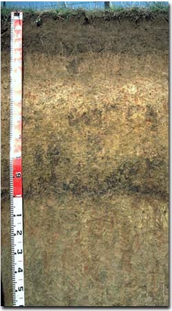 |
| Ferrosols (previously referred to as ‘krasnozems’) are deep, strongly-structured and friable red and brown soils that have formed on basalt. They are high in free iron oxide and clay, and are generally strongly acid. Ferrosols are common in the Ballarat and Daylesford regions and are well suited for horticulture More detailed information about Ferrosols in Victorian grain cropping regions. | 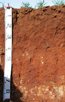 |
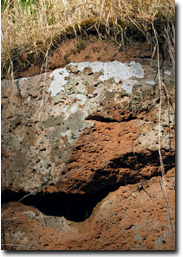
| Calcarosols are calcareous throughout and contain calcium carbonate (lime) as soft or hard white fragments, usually increasing at depth. They are widespread soils in the Mallee and Wimmera grain cropping region. Medium textured Calcarosols are common in the central and northern Mallee region. These soils typically have sandy loam to light sandy clay loam surface horizons, and soil texture increases gradually with depth further down the soil profile. In many areas these soils occur in association with Calcareous sands on east-west dunes. Heavy textured Calcarosols are common on lower slopes and plains in the southern Mallee and northern Wimmera regions where east-west dunes are less frequent. They typically have a clay loam to light clay surface and the texture increases gradually with depth further down the soil profile. The heavier textured Calcarosols can often be gilgaied on the plains and ridge slopes. In some areas, these soils may grade into Vertosols. | 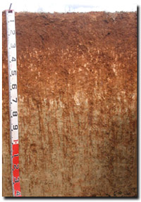 |
More detailed information about Calcarosols in Victorian grain cropping regions.
Shallow and stony soils
Relevant information elsewhere on VRO website
For more detailed soil/landscape mapping and information about regional soils and landforms in particular areas please access these regional areas of the VRO website:
Mallee region
Wimmera region
North Central region
Goulburn Broken region
North East region
Corangamite region
Glenelg-Hopkins region
West Gippsland region
Also, The Soil and Land Survey Directory enables you to search for and access legacy soil and landscape survey reports based on a Local Government Area or catchment management region of interest.


