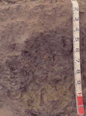
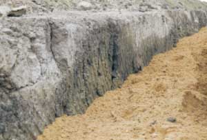
SW83
|
| SW83 |  Vertic (& Calcic), Subnatric, Black SODOSOL | |
| East of Colac, between Warncoort-Birregurra road and railway line | |||
| Gently undulating plain | |||
| Quaternary basalt | |||
| Flat | |||
| 0 | |||
| 0 | |||
Horizon | Depth (cm) | Description | ||
A1 | 0-10 | Very dark brown (10YR2/2 moist), dark greyish brown (10YR4/2 dry); loam; pH 5.5; clear change to: | ||
A2 | 10-60 | Dark greyish brown (10YR4/2 moist), conspicuously bleached; (10YR7/2 dry); sandy clay loam; apedal massive structure; few [2%], fine buckshot nodules [concentrated in pockets]; pH 6.6; abrupt and wavy change to: | ||
B21 | 60-90 | Black (10YR2/1 moist); heavy clay; few pockets of ferruginous fine gravel; coarse prismatic structure; pH 6.8; abrupt change to: | ||
B22 | 90 + | Mottled dark greyish brown grey with (10YR6/1 moist) and minor (<2%), brownish yellow (10YR6/8 moist) and light olive brown (2.5Y5/4 moist) mottles, soft calcareous segregations; strongly vertic; medium clay; medium prismatic structure; pH 8.6. | ||
| Management considerations | ||||
| The soil is a ‘hollow’ in a variable Gilgai complex comprising Sodosols, Chromosols (SW82) and Vertosols (SW84). Waterlogging and shrink-swell activity of the clays are the principle hazards in this landscape. | ||||
Analytical data
Site SW83 | Sample depth | pH | EC | NaCl | Ex Ca | Ex Mg | Ex K | Ex Na | Ex Al | Ex acidity | FC (-10kPa) | PWP (-150kPa) | KS | FS | Z | C | |
Horizon | cm | H2O | CaCl2 | dS/m | % | cmolc/kg | cmolc/kg | cmolc/kg | cmolc/kg | mg/kg | cmolc/kg | % | % | % | % | % | % |
A1 | 0-10 | 5.5 | 4.9 | 0.21 | N/R | 6.2 | 3.2 | 0.61 | 0.37 | <10 | 12 | 25.6 | 10.8 | 22.9 | 37 | 13.5 | 20.5 |
A2 | 10-60 | 6.6 | 6 | 0.06 | N/R | 1.7 | 1.4 | <0.05 | 0.18 | N/R | 3.3 | 16.6 | 3.8 | 28.6 | 46.2 | 14 | 11.5 |
B21 | 60-90 | 6.8 | 5.6 | 0.11 | N/R | 5.9 | 11 | 0.3 | 2.4 | N/R | 11 | 39.4 | 22.4 | 14.4 | 21.4 | 7 | 54.5 |
B22 | 90+ | 8.6 | 7.5 | 0.25 | N/R | 7 | 12 | 0.28 | 4 | N/R | N/R | 39.3 | 19.9 | 15.3 | 28.4 | 7.5 | 46.5 |


