SW82
|
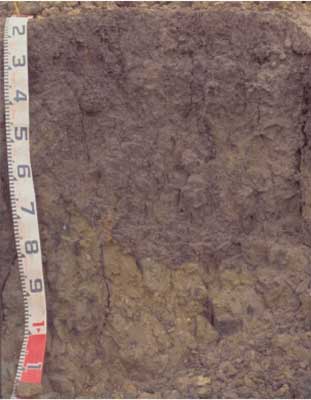
| SW82 |  Vertic (& Sodic), Calcic Black CHROMOSOL | |
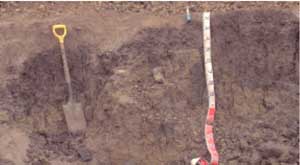
| East of Colac, between Warncoort-Birregurra road and railway line | |||
| Gently undulating plain | |||
| Quaternary basalt | |||
| Flat | |||
| 0 | |||
| 0 | |||
Horizon | Depth (cm) | Description | ||
A1 | 0-10 | Very dark brown (10YR2/2 moist and 10YR4/2 dry); pH 5.5; loam; clear boundary to: | ||
B21 | 10-40 | Black (10YR3/2 moist); medium heavy clay; medium to fine (5-20 mm) polyhedral structure; strong consistence; pH 5.8; gradual boundary to: | ||
B22 | 40-90 | Black (10YR2/1 moist); heavy clay; some pockets of fine buckshot; coarse prismatic, parting to fine lenticular structure; strong consistence; pH 6.8; abrupt boundary to: | ||
B23ssgk | 90 + | Dark greyish brown (10YR4/2 moist) with brownish yellow (10YR6/6 moist) and minor (<2%), light olive brown (2.5Y5/4 moist) mottles; soft carbonate and strongly vertic; medium (20-50 mm) prismatic structure; strong consistence; pH 8.5. | ||
| Management considerations | ||||
| The soil is a ‘puff’ in a variable Gilgai complex comprising Sodosols (SW83), Chromosols and Vertosols (SW84). Waterlogging and shrink-swell activity of the clays are the principle hazards in this landscape. | ||||
Analytical data
Site SW82 | Sample depth | pH | EC | NaCl | Ex Ca | Ex Mg | Ex K | Ex Na | Ex Al | Ex acidity | FC (-10kPa) | PWP (-150kPa) | KS | FS | Z | C | |
Horizon | cm | H2O | CaCl2 | dS/m | % | cmolc/kg | cmolc/kg | cmolc/kg | cmolc/kg | mg/kg | cmolc/kg | % | % | % | % | % | % |
A1 | 0-10 | 5.5 | 4.9 | 0.21 | N/R | 6.2 | 3.2 | 0.61 | 0.37 | <10 | 12 | 25.6 | 10.8 | 22.9 | 37 | 13.5 | 20.5 |
B21 | 10-40 | 5.8 | 4.8 | 0.10 | <0.01 | 7.2 | 7.9 | 0.4 | 0.5 | 18 | 15 | 39.6 | 24.6 | 12.5 | 20.5 | 7 | 55.5 |
B22 | 40-90 | 6.8 | 5.6 | 0.09 | N/R | 7.9 | 13 | 0.41 | 1.8 | N/R | N/R | 45.5 | 26.7 | 10.6 | 15.7 | 5.5 | 63 |
B23 | 90+ | 8.5 | 7.3 | 0.17 | N/R | 6.5 | 12 | 0.27 | 3.2 | N/R | N/R | N/R | N/R | 17.8 | 24.6 | 7 | 48 |


