
2.1.4 Hills, valley slopes and plains on granitic Palaeozoic rock (Wartook, Rocky Point)
|
The granite plutons away from the steep and topographically prominent landforms (Langi Ghiran, western Black Range) are generally subdued hills, low hills and plains with deeply weathered bedrock (such as those at Rocky Point) and the footslopes surrounding prominent mountains and escarpments. | 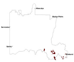 |
Soil profiles with sandy surfaces and strongly texture contrast are common on these granite landscapes. Sodic yellow texture contrast soils are strongly acidic at surface, becoming slightly acidic or neutral at depth. Conspicuously bleached subsurface horizons overlie medium to heavy clays that act as a hydraulic throttle to water movement through the soil profile. Lighter weathered material often occurs under these clays. Soils are generally deeper than those of Langi Ghrian and the western Black Range.
Vegetation communities include Grassy Dry Forest, Granitic Hills Woodland, Grassy Woodland, Herbrich Woodland, and Granitic Hills Woodland on more exposed slopes where Alluvial Terraces and Herb-rich Woodland occupy lower slopes and drainage depressions.
Saline discharge occurs at the break-of-slope as perched groundwater moves laterally downslope through colluvium of footslopes and foothills. Occasionally this groundwater contributes to underlying basal aquifers in valleys.
Granitic slopes are prone to sheet and rill erosion from extreme rainfall events. Landslides and mud flows can eventuate where significant rainfall is combined with land clearance and steep slopes causing soils to fail (e.g. Rocky Point).
Soil-landform unit | Unit description | Area (km2) |
| Langi Ghiran colluvial footslopes | Colluvial footslopes | 35 |
| Rocky Point low hills/rises | Undulating rises and low hills | 42 |
| Sugarloaf granite hills | Granitic hills | 88 |
| Wartook granite hills | Moderate-steep hills | 23 |
© State of Victoria (Agriculture Victoria) 1996 - .

This work, Victorian Resources Online, is licensed under a Creative Commons Attribution 4.0 licence. You are free to re-use the work under that licence, on the condition that you credit the State of Victoria (Agriculture Victoria) as author, indicate if changes were made and comply with the other licence terms.
The licence does not apply to ‘branding’ or some ‘images or photographs’ that may be owned by third parties. We ask you to seek prior approval to use images using the VRO feedback form. Access to higher quality images can also be provided on request.
This page was last updated on .