
Soil/Landform Unit - St Helens gentle plains
Landform Unit Description
Page top
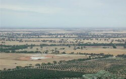 Gentle plains north-west from Mount Zero |
1.37% of CMA region Gently undulating plains that lie either side of the Wimmera River valley centred on Horsham are known as the St Helens plains. This simple plain unit is part of the North West Dunefields and Plains; clay plains and subdued depressions divisions (5.4). These plains occupy the outwash slopes of the Grampians in the south and are bound by flats and drainage depressions. This unit also occupies the boundary between the clay plains to the south, the Wimmera River valley to the west and north-east of Horsham. Minor dunes occur on the plains. Grey cracking clays (Vertosols) with sodic red (occasionally brown) texture contrast soils (mainly on the dunes) are the major soil types. Waterlogging is a potential issue on the clay soils, while sheet and rill erosion is more significant on the dune slopes. This unit is used for dryland cropping, grazing (sheep, beef cattle) and some water supply function in some areas. Remnant vegetation communities recorded include woodlands. |  |
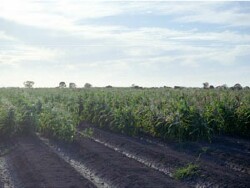 Raised bed trials west of Horsham | 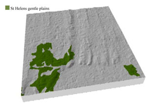 |
 | 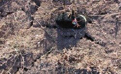 Cracking self-mulching soil surfaces |
Component | 1 | 2 |
Proportion of soil-landform unit | 5% | 95% |
| CLIMATE Rainfall (mm) | Annual: 480 | |
| Temperature (oC) | Minimum 8, Maximum 21 | |
| Precipitation less than potential evapotranspiration | October–April | |
| GEOLOGY Age and lithology | Quaternary fluvial silt, sand and minor gravel (Shepparton Formation); Neogene marine sand and silt (Parilla Sand); Quaternary alluvium gravel, sand and silt | |
| Geomorphology | ||
| LANDUSE | Uncleared areas: water supply; nature conservation Cleared areas: dryland cropping; sheep grazing; water supply | |
| TOPOGRAPHY Landscape | Gentle plains | |
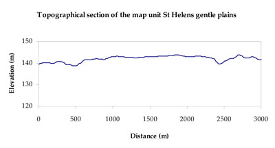
| Elevation range (m) | 113–155 | |
| Local relief (m) | 2–3 | |
| Drainage pattern | Dendritic | |
| Drainage density (km/km2) | 0.4 | |
| Landform | Gently undulating plains | |
| Landform element | Dune slope | Gently undulating plain |
| Slope and range (%) | 4 (1-6) | 2 (0-5) |
| Slope shape | Convex | Straight |
| NATIVE VEGETATION Ecological Vegetation Class | Plains Woodland (28.6%), Riverine Chenopod Woodland (23.7%), Plains Savannah (8.5%), Other (22.4%) | |
| SOIL Parent material | Aeolian sand | Marine sand and silt, fluvial gravel, sand and silt |
| Description (Corangamite Soil Group) | Sodic red texture contrast soils (39) | Cracking clay soils (34) |
| Soil type sites | ||
| Surface texture | Sandy clay loam | Medium clay |
| Permeability | Moderate | Slow to moderate |
| Depth (m) | > 3 | > 3 |
| LAND CHARACTERISTICS, POTENTIAL AND LIMITATIONS Critical land features, processes, forms | Hardsetting upper soil susceptible to wind erosion when exposed. Dispersive and deep subsoils susceptible to gully erosion on steeper slopes. Compaction of upper soil variable depending on soil depth and moisture content. Upper soil is susceptible to acidification. | High clay content results in restricted soil drainage, but can be variable due to micro relief (gilgai). Slightly susceptible to surface sheet erosion where slopes occur and gully erosion where dispersive subsoil is exposed. Surface soils are friable and only slightly susceptible to wind erosion due to self-mulching nature. Soils may be susceptible at critical moisture contents and have variable resilience to compaction. |
© State of Victoria (Agriculture Victoria) 1996 - .

This work, Victorian Resources Online, is licensed under a Creative Commons Attribution 4.0 licence. You are free to re-use the work under that licence, on the condition that you credit the State of Victoria (Agriculture Victoria) as author, indicate if changes were made and comply with the other licence terms.
The licence does not apply to ‘branding’ or some ‘images or photographs’ that may be owned by third parties. We ask you to seek prior approval to use images using the VRO feedback form. Access to higher quality images can also be provided on request.
This page was last updated on .