
Soil/Landform Unit - Minimay plains
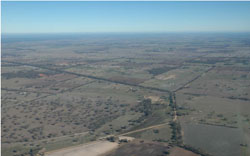 View west from Minimay towards the plains and West Wimmera wetlands |
0.18% of CMA region This unit of low-lying terrain consists of a few main occurrences with a few smaller outliers just south of the Little Desert, near Minimay. These flats and plains are part of North West Dunefields and Plains; ridges with sand and flats geomorphological unit (5.5.2). These low-lying swales and plains lie between ridges that are orientated NNW/SSE with only two landform components. Plains and flats are dominant with swamps and lakes the minor component. Soil types are predominantly grey and brown cracking clay soils (Vertosols) with minor sodic texture contrast soils (Sodosols). Waterlogging and compaction are potential land degradation susceptibilities. Timing of land management activities is important given the heavy nature of the soils and landscape position. Vegetation communities such as Red Gum Wetland, Freshwater Lake Mosaic, Lignum Swampy Woodland and several Red Gum mosaic formations are associated with the water bodies. Other vegetation communities present include Low Rises Woodland, Sandstone Ridge Shrubland and Plains Savannah. | 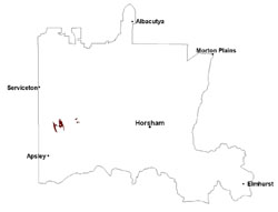 |
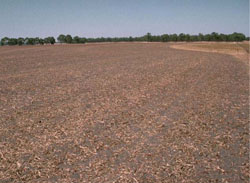 Self-mulching clays near Minimay | 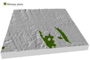 |
 | 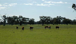 Cattle grazing and remnant vegetation near Minimay |
Component | 1 | 2 |
Proportion of soil-landform unit | 90% | 10% |
| CLIMATE Rainfall (mm) | Annual: 535 | |
| Temperature (oC) | Minimum 8, Maximum 21 | |
| Precipitation less than potential evapotranspiration | September–April | |
| GEOLOGY Age and lithology | Quaternary paludal silt and clay; Quaternary aeolian dune sand (Lowan Sand); Neogene marine sand and silt (Parilla Sand) | |
| Geomorphology | ||
| LANDUSE | Uncleared areas: water supply; nature conservation Cleared areas: dryland cropping; sheep and cattle grazing | |
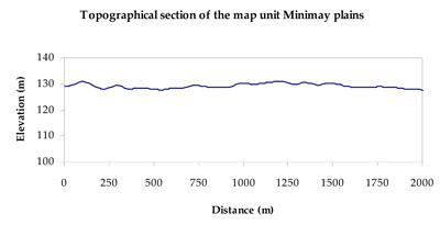
| TOPOGRAPHY Landscape | Gently undulating plains | |
| Elevation range (m) | 119–153 | |
| Local relief (m) | 5 | |
| Drainage pattern | Dendritic | |
| Drainage density (km/km2) | 0.3 | |
| Landform | Plains | |
| Landform element | Plain, gentle slope and flat | Swamp, water and closed depression |
| Slope and range (%) | 2 (0-5) | 0 (0-2) |
| Slope shape | Straight | Concave |
| NATIVE VEGETATION Ecological Vegetation Class | Plains Woodland (41.2%), Plains Savannah (39.7%), Shallow Sands Woodland (7.3%), Other (11.8%) | |
| SOIL Parent material | Marine sand and silt, aeolian sand, and paludal silt and clay | Paludal silt and clay |
| Description (Corangamite Soil Group) | Grey and brown cracking clay soils (37) | Grey and brown cracking clay soils (37) |
| Soil type sites | LS3, LSWW9, LSWW5 | LS3, LSWW9, LSWW5 |
| Surface texture | Medium clay | Medium clay |
| Permeability | Slow | Very slow |
| Depth (m) | > 2 | > 2 |
| LAND CHARACTERISTICS, POTENTIAL AND LIMITATIONS Critical land features, processes, forms | Susceptible to inundation and waterlogging in lower areas, but can be variable due to micro relief (gilgai). Surface soils friable and only slightly susceptible to wind erosion. Soils susceptible to compaction at critical moisture contents. | Susceptible to seasonal inundation and waterlogging. Surface soils friable and only slightly susceptible to wind erosion when exposed. Soils susceptible to compaction at critical moisture contents. |
© State of Victoria (Agriculture Victoria) 1996 - .

This work, Victorian Resources Online, is licensed under a Creative Commons Attribution 4.0 licence. You are free to re-use the work under that licence, on the condition that you credit the State of Victoria (Agriculture Victoria) as author, indicate if changes were made and comply with the other licence terms.
The licence does not apply to ‘branding’ or some ‘images or photographs’ that may be owned by third parties. We ask you to seek prior approval to use images using the VRO feedback form. Access to higher quality images can also be provided on request.
This page was last updated on .