
Soil/Landform Unit - Langkoop clay plains
 Cleared clay plains are cropped and grazed |
0.17% of CMA region Clay plains in the south-west of the Wimmera CMA region consist of a sequence including plains and gentle slopes, drainage depressions and swamps. Occurring as two units either side of Mosquito Creek, the plains are known for their grey and brown cracking clay soils (Vertosols) and sodic brown, yellow and grey texture contrast soils (Sodosols). Land use is mainly cereal cropping and fodder production along with grazing by sheep and cattle. Land can be susceptible to waterlogging and pugging by stock in lower areas where soils compact at critical moisture contents. Vegetation is dominated by Plains Grassy Woodland that is found mostly on freely draining soils. | 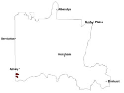 |
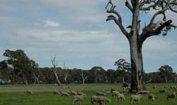
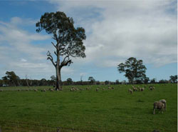 Sheep grazing on clay plain near Langkoop | 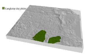 |
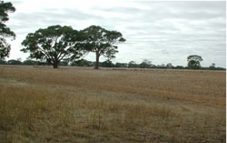
 |  Clay plain with red gum at Moolah property |
Component | 1 | 2 | 3 | 4 |
Proportion of soil-landform unit | 20% | 65% | 5% | 10% |
| CLIMATE Rainfall (mm) | Annual: 615 | |||
| Temperature (oC) | Minimum 8, Maximum 21 | |||
| Precipitation less than potential evapotranspiration | October–April | |||
| GEOLOGY Age and lithology | Neogene marine sand and silt (Parilla Sand) | |||
| Geomorphology | ||||
| LANDUSE | Uncleared areas: Nature conservation Cleared areas: Dryland cropping; sheep grazing | |||
| TOPOGRAPHY Landscape | Clay plains | |||
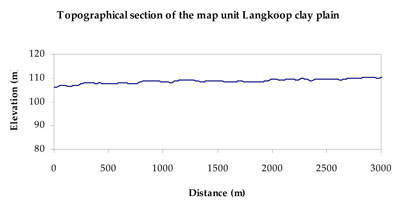
| Elevation range (m) | 97–120 | |||
| Local relief (m) | 2 | |||
| Drainage pattern | Dendritic | |||
| Drainage density (km/km2) | 0.4 | |||
| Landform | Plains | |||
| Landform element | Gentle slope | Plain | Drainage depression | Swamp |
| Slope and range (%) | 2 (1-7) | 0 (0-1) | 0 (0-1) | 0 (0-2) |
| Slope shape | Convex | Straight | Concave | Concave |
| NATIVE VEGETATION Ecological Vegetation Class | Plains Grassy Woodland (42.2%), Unclassified (57.8%) | |||
| SOIL Parent material | Marine sand and silt | Marine sand and silt | Paludal silt and clay | Paludal silt and clay |
| Description (Corangamite Soil Group) | Sodic brown, yellow and grey texture contrast soils (38) | Grey and brown cracking clay soils (37) | Grey and brown cracking clay soils (37) | |
| Soil type sites | LSWW11, LSWW17, LSWW13 | LS3, LSWW9, LSWW11 | LS3, LSWW9, LSWW5 | LS3, LSWW9, LSWW5 |
| Surface texture | Loamy sand | Loamy sand to medium clay | Medium clay | Medium clay |
| Permeability | Moderate | Slow to moderate | Slow | Slow |
| Depth (m) | > 2 | > 2 | > 2 | > 2 |
| LAND CHARACTERISTICS, POTENTIAL AND LIMITATIONS Critical land features, processes, forms | Susceptible to wind and sheet erosion where exposed surfaces have little organic matter. Susceptible to compaction where hardsetting and restricted drainage. | Susceptible to inundation and waterlogging in lower areas, but can be variable due to micro relief (gilgai). Slightly susceptible to surface sheet erosion where soils are exposed. Gully erosion can occur where subsoils are dispersive and deep. Surface soils friable and only slightly susceptible to wind erosion. Soils susceptible to compaction at critical moisture contents. | Susceptible to seasonal inundation and waterlogging. Surface soils friable and only slightly susceptible to wind erosion. Soils susceptible to compaction at critical moisture contents. | Susceptible to periodic inundation, waterlogging and soil salinity. Slightly susceptible to surface sheet erosion when soils are exposed. Surface soils are friable and only slightly susceptible to wind erosion. Soils susceptible to compaction at critical moisture contents. |
© State of Victoria (Agriculture Victoria) 1996 - .

This work, Victorian Resources Online, is licensed under a Creative Commons Attribution 4.0 licence. You are free to re-use the work under that licence, on the condition that you credit the State of Victoria (Agriculture Victoria) as author, indicate if changes were made and comply with the other licence terms.
The licence does not apply to ‘branding’ or some ‘images or photographs’ that may be owned by third parties. We ask you to seek prior approval to use images using the VRO feedback form. Access to higher quality images can also be provided on request.
This page was last updated on .