
Soil/Landform Unit - Darragan rolling rises
 Rolling rises to the north-east across a corridor to a former stranded beach ridge |
0.40% of CMA region Rolling rises south of Horsham represent a sequence of ferruginised Neogene sediments (Parilla Sand) as part of the prominent ridges with eroded ferruginised northern spurs of the North Western Dunefields and Plains (5.5.3). Comprising rolling rises and defined drainage lines, major soils include sodic red and brown texture contrast soils (Sodosols) with cracking clays (Vertosols) confined to lower drainage depressions and flats. Soils are prone to compaction due to hardsetting surfaces that benefit from organic matter contributions to improve soil structure. Land use is variable between dryland cereal cropping, sheep and cattle grazing and occasional intensive industries (e.g. viticulture). Dominant woodland remnant vegetation includes Heathy Woodland, Riverine Chenopod Woodland, Grassy Woodland, Creekline Sedgy Woodland, Plains Woodland and Shallow Sands Woodland. Sandstone Ridge Shrubland is also found along ridges and rises in the landscape. | 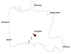 |
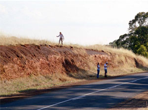 Ferruginised Parilla Sand cutting | 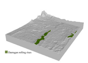 |
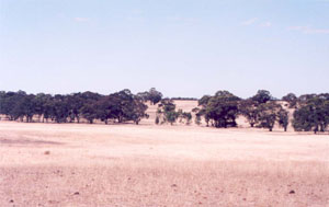
 | 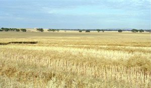 Looking southwards across cropped plains towards a rolling rise |
Component | 1 | 2 |
Proportion of soil-landform unit | 10% | 90% |
| CLIMATE Rainfall (mm) | Annual: 500 | |
| Temperature (oC) | Minimum 8, Maximum 21 | |
| Precipitation less than potential evapotranspiration | October–April | |
| GEOLOGY Age and lithology | ||
| Geomorphology | ||
| LANDUSE | Uncleared areas: nature conservation Cleared areas: dryland cropping; sheep and beef cattle grazing; gravel extraction | |
| TOPOGRAPHY Landscape | Rolling rises | |
| Elevation range (m) | 117–193 | |
| Local relief (m) | 10–15 | |
| Drainage pattern | Parallel | |
| Drainage density (km/km2) | 0.5 | |
| Landform | Rises | |
| Landform element | Creek/drainage line | Rolling to undulating rise |
| Slope and range (%) | 4 (1-7) | 6 (3-10) |
| Slope shape | Convex | Concave |
| NATIVE VEGETATION Ecological Vegetation Class | Grassy Woodland (35.0%), Plains Woodland (32.5%), Creekline Sedgy Woodland (13.3%), Sandstone Ridge Shrubland (12.6%), Other (6.1%) | |
| SOIL Parent material | Alluvial gravel, sand and silt | Marine sand and silt |
| Description (Corangamite Soil Group) | Grey and brown cracking clay soils (37) | Sodic red and brown texture contrast soils (40) |
| Soil type sites | LS3, LSWW9, LSWW5 | |
| Surface texture | Medium clay | Loamy sand |
| Permeability | Slow | Moderate |
| Depth (m) | > 2 | < 2 |
| LAND CHARACTERISTICS, POTENTIAL AND LIMITATIONS Critical land features, processes, forms | Susceptible to inundation and waterlogging in lower areas. Slightly susceptible to surface sheet erosion where soils are exposed. Surface soils are friable and only slightly susceptible to wind erosion. Soils are susceptible to compaction at critical moisture contents. | Weakly structured or hardsetting upper soil susceptible to sheet and rill erosion especially where significant slopes occur. Sandy surfaces can be susceptible to wind erosion. Dispersive and deep subsoils susceptible to gully erosion on steeper slopes. Ferricrete occurs at depth. |
© State of Victoria (Agriculture Victoria) 1996 - .

This work, Victorian Resources Online, is licensed under a Creative Commons Attribution 4.0 licence. You are free to re-use the work under that licence, on the condition that you credit the State of Victoria (Agriculture Victoria) as author, indicate if changes were made and comply with the other licence terms.
The licence does not apply to ‘branding’ or some ‘images or photographs’ that may be owned by third parties. We ask you to seek prior approval to use images using the VRO feedback form. Access to higher quality images can also be provided on request.
This page was last updated on .