
Soil/Landform Unit 99
Landform Unit Description
Page top
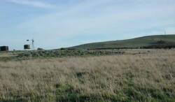
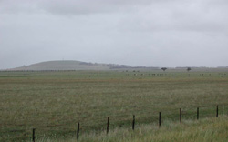 Looking east towards Mount Gellibrand over the basalt plains |
0.01% of CMA region The moderately inclined high cone (hill) of Mount Gellibrand is characterised by abundant surface rock and significant topographic relief over the neighbouring basaltic plains and stony rises. This significant high cone of the Western Plains has shallow to moderately deep alkaline black gradational soils. These soils are generally friable and productive but are somewhat limited by shallow depth. Little remnant vegetation exists on the cone with only Scoria Cone Woodland at 0.5% recognised. The relatively young landscape has an annual rainfall in excess of 700 mm. Land use is constrained given the high levels of surface rock. Sheep and beef cattle grazing are common on the slopes, with dairying occurring on the lower slopes and across the surrounding area. Erosion hazards include rapid nutrient decline owing to the steep slopes and waterlogging on lower slopes. | 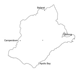 |
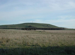 Mount Gellibrand is mainly used for grazing due to slopes and surface stone | 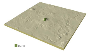 |
 |  Stony outcrop at the base of Mount Gellibrand |
Component | 1 |
Proportion of soil-landform unit | 100% |
| CLIMATE Rainfall (mm) | Annual: 730 |
| Temperature (oC) | Minimum8, Maximum 19 |
| Precipitation les than potential evapotranspiration | Octber-Marsh |
| GEOLOGY Age and lithology | Quaternary basalt and scoria |
| Geomorphology | |
| LANDUSE | Uncleared areas: Nature conservation Cleared areas: Sheep and beef cattle grazing |
| TOPOGRAPHY Landscape | Moderately inclined high cone |
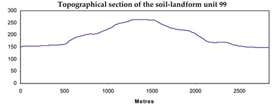
| Elevation range (m) | 158-264 |
| Local relief (m) | 125 |
| Drainage pattern | Centripetal |
| Drainage density (km/km2) | <0.1 |
| Landform | Volcanic cone |
| Landform element | Cone |
| Slope and range (%) | 15 (10-25) |
| Slope shape | Concave |
| NATIVE VEGETATION Ecological Vegetation Class | Scoria Cone Woodland (0.5%) |
| SOIL Parent material | Scoria, basalt |
| Description (Corangamite Soil Group) | Alkaline, well structured black, gradational soils (40) |
| Soil type sites | |
| Surface texture | Clay loam |
| Permeability | High to moderate |
| Depth (m) | <1.5 |
| LAND CHARACTERISTICS, POTENTIAL AND LIMITATIONS | Friable structured soil. Soil depth may be moderately deep to deep wtih moderate water holding capacity. Well drained and high nutrient holding capacity. Upper soil may be acidic. |
© State of Victoria (Agriculture Victoria) 1996 - .

This work, Victorian Resources Online, is licensed under a Creative Commons Attribution 4.0 licence. You are free to re-use the work under that licence, on the condition that you credit the State of Victoria (Agriculture Victoria) as author, indicate if changes were made and comply with the other licence terms.
The licence does not apply to ‘branding’ or some ‘images or photographs’ that may be owned by third parties. We ask you to seek prior approval to use images using the VRO feedback form. Access to higher quality images can also be provided on request.
This page was last updated on .