
Soil/Landform Unit 51
Landform Unit Description
Page top
 The basalt flow occurs between Buininyong to Clarendon. The flow has significant relief over neighbouring sedimentary units |
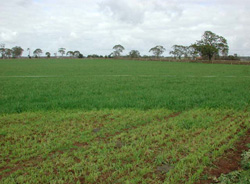
0.04% of CMA region This plain is derived from a significant basalt flow that stretches from Buninyong to Clarendon. Ordovician sediments surround the plain to the north-east and other sedimentary topographies to the west. As part of the Midlands, this unit runs along the Midland Highway between the two towns in a relatively narrow geological strip. Soils on the gently undulating broad crests are rich, friable, well structured red gradational soils that offer high value and versatility to agriculture. Remnant vegetation classes include Plains Grassy Woodland and Herb-rich Foothill Forest. The dominant species are Eucalyptus viminalis, E. radiata and E. obliqua. Agricultural land use includes beef cattle and sheep grazing, however the pressures of residential development have seen much of this land removed from agricultural production. Erosion hazards are minimal. | 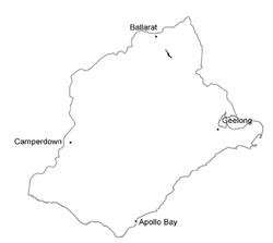 |
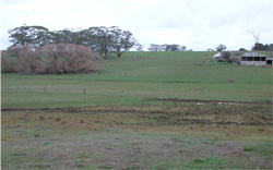
 Plain near Clarendon, cropping, grazing and residential development are the main land uses | 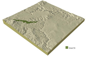 |
|
Component | 1 | 2 | 3 | 4 |
Proportion of soil-landform unit | 25% | 25% | 25% | 25% |
| CLIMATE Rainfall (mm) | Annual: 770 | |||
| Temperature (oC) | Minimum 7, Maximum 17 | |||
| Precipitation less than potential evapotranspiration | November-March | |||
| GEOLOGY Age and lithology | Quaternary basalt, sands and clays and minor Ordovician marine sandstone and shale | |||
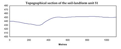
| Geomorphology | ||||
| LANDUSE | Uncleared: Nature conservation; regional development; passive and active recreation Cleared: Regional development; grazing | |||
| TOPOGRAPHY Landscape | Gently undulating plainw ith broad crests | |||
| Elevation range (m) | 412-545 | |||
| Local relief (m) | 4 | |||
| Drainage pattern | Dendritic | |||
| Drainage density (km/km2) | 1.2 | |||
| Landform | Undulating plain | Terrace | ||
| Landform element | Crest and upper slopes | Mid slope | Lower slope and depression | |
| Slope and range (%) | 3 (1-6) | 3 (2-7) | 1 (1-2) | 1 (1-2) |
| Slope shape | Convex | Straight | Concave | Straight |
| NATIVE VEGETATION Ecological Vegetation Class | Plains Grassy Woodland (5.5%); Herb-rich Foothill Forest (0.9%) | |||
| Dominant species | E. viminalis, E. radiata, E. obliqua | E. viminalis, E. radiata, E. obliqua | E. viminalis, E. radiata, E. obliqua | E. viminalis, E. radiata |
| SOIL Parent material | In situ weathered basalt | In situ weathered basalt | In situ weathered basalt | Unconsolidated gravel, sand, silt and clay |
| Description (Corangamite Soil Group) | Red gradational soil, fine structure (40) | Dark red gradational soil, fine structure (40) | Dark brown soil (variable) (34) | |
| Soil type sites | ||||
| Surface texture | Clay loam | Loam | Clay loam | Fine sandy clay loam |
| Permeability | High | High | Moderate to low | Moderate to low |
| Depth (m) | 2 | 1.5 | 1.5 | 2 |
| LAND CHARACTERISTICS, POTENTIAL AND LIMITATIONS | Slope, exposure to southerly wind and rain, leaching, overland flow, sheet erosion, nutrient decline are very minor limitations. | Slope, hardsetting surfaces, leaching, overland flow, compaction, sheet erosion and nutrient decline are very minor limitations. | Low permeability, hardsetting surfaces, waterlogging and soil compaction are very minor limitations. | Low-lying areas receiving drainage are susceptible to waterlogging, overland flow, stream bank erosion and gully erosion |
© State of Victoria (Agriculture Victoria) 1996 - .

This work, Victorian Resources Online, is licensed under a Creative Commons Attribution 4.0 licence. You are free to re-use the work under that licence, on the condition that you credit the State of Victoria (Agriculture Victoria) as author, indicate if changes were made and comply with the other licence terms.
The licence does not apply to ‘branding’ or some ‘images or photographs’ that may be owned by third parties. We ask you to seek prior approval to use images using the VRO feedback form. Access to higher quality images can also be provided on request.
This page was last updated on .