
Soil/Landform Unit 45
Landform Unit Description
Page top
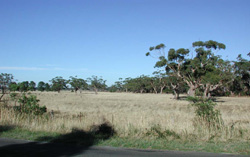 Level plain and depressions at Pootilla with a remnant reserve of swamp gums (Eucalyptus ovata) |
0.09% of CMA region The gently undulating rises in the Pootilla area form part of a sequence of volcanic landforms within the Western Uplands. These plains are characterised by majestic stands of swamp gum (E. ovata) on the flats and depressions between the gently undulating rises. The vegetation classes include Herb-rich Foothill Forest, Plains Grassy Woodland and Creekline Herb-rich Woodland with the dominant species being swamp gum (E. ovata) and narrow leaf peppermint (E. radiata). The area consists of a variety of texture contrast soils with shallow black cracking clays. The soils of the open depressions are mottled black texture contrast soils. Land use is mainly grazing for beef cattle and sheep, and cropping of cereal and potatoes. Soil compaction is a problem on the lower slopes and depressions, along with seasonal waterlogging in the depressions. |  |
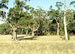 Swamp gums (Eucalyptus ovata) on black cracking clays | 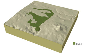 |
|
Component | 1 | 2 | 3 |
Proportion of soil-landform unit | 34% | 33% | 33% |
| CLIMATE Rainfall (mm) | Annual: 890 | ||
| Temperature (oC) | Minimum6, Maximum 17 | ||
| Precipitation less than potential evapotranspiration | November-March | ||
| GEOLOGY Age and lithology | Pleistocene; basalt | ||
| Geomorphology | |||
| LANDUSE | Uncleared: Nature conservation Cleared: Beef cattle and sheep grazing; potatoes; cropping (cereal) | ||
| TOPOGRAPHY Landscape | Gently undulating rises | ||
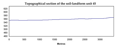
| Elevation range (m) | 520-607 | ||
| Local relief (m) | 4 | ||
| Drainage pattern | Dendritic | ||
| Drainage density (km/km2) | 3.5 | ||
| Landform | Undulating plains and low rises | ||
| Landform element | Crest and upper slope | Mid slope | Unconsolidated sediments |
| Slope and range (%) | 3 (1-6) | 4 (2-7) | 1 (1-2) |
| Slope shape | Convex | Straight | Concave |
| NATIVE VEGETATION Ecological Vegetation Class | Herb-rich Foothill Forest (5.9%), Plains Grassy Woodland (0.3%), Creekline Herb-rich Woodland (0.3%0 | ||
| Dominant species | E. viminalis, E. radiata, E. obliqua | ||
| SOIL Parent material | In situ weathered basalt | In situ weathered basalt | In situ weathered basalt |
| Description (Corangamite Soil Group) | Red gradational soil, fine structure (40) | Dark red gradational soil, fine structure (40) | |
| Soil type sites | |||
| Surface texture | Clay loam | Loam | Clay loam |
| Permeability | High | High | Moderate to low |
| Depth (m) | 2 | 1.5 | 1.5 |
| LAND CHARACTERISTICS, POTENTIAL AND LIMITATIONS | Low slopes, hardsetting and slowly permeable subsoils often result in overland flow and periodic waterlogging. Soil compaction and sheet erosion also occur. | Low slopes, hardsetting surface and slowly permeable subsoils often result in overland flow and periodic waterlogging. Soil compaction and sheet erosion also occur. | Low slopes, hardsetting surfaces and slowly permeable subsoils often result in overland flow and periodic waterlogging. Soil compaction and sheet erosion also occur. |
© State of Victoria (Agriculture Victoria) 1996 - .

This work, Victorian Resources Online, is licensed under a Creative Commons Attribution 4.0 licence. You are free to re-use the work under that licence, on the condition that you credit the State of Victoria (Agriculture Victoria) as author, indicate if changes were made and comply with the other licence terms.
The licence does not apply to ‘branding’ or some ‘images or photographs’ that may be owned by third parties. We ask you to seek prior approval to use images using the VRO feedback form. Access to higher quality images can also be provided on request.
This page was last updated on .