
Soil/Landform Unit 191
Landform Unit Description
Page top
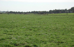 Sedimentary alluvial flats between near Swan Marsh |
0.28% of CMA region This unit consists of level to very gently undulating plains of colluvial and alluvial origin that have resulted from the juncture of the basaltic plains and the older sedimentary (Neogene) plains, as well as the alluvial flats between Lakes Corangamite and Colac. These sedimentary alluvial flats of the Western Plains comprise the landform elements of plains and depressions. They make up a complex of terrain units with other slightly higher landforms (such as stony rises, lunettes and bordering scoria volcanics) of this area. Given the low topographic position of the flats and depressions, native remnant vegetation is limited to Swamp Scrub. The soils are predominantly cracking clays with some strongly sodic soils on the backplain. While organic matter content is high in these soils, they are susceptible to inundation, waterlogging and possibly compaction. | 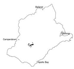 |
 Associated with this unit are low slopes and plains of unit 175 | 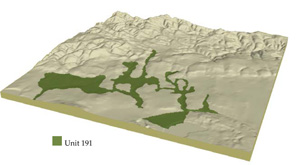 |
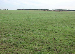
 | 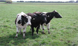 Dairy is the main land used of these undulating plains |
Component | 1 | 2 | 3 |
Proportion of soil-landform unit | 50% | 45% | 5% |
| CLIMATE Rainfall (mm) | Annual: 830 | ||
| Temperature (oC) | Minimum 8, Maximum 19 | ||
| Precipitation less than potential evapotranspiration | November–March | ||
| GEOLOGY Age and lithology | |||
| Geomorphology | |||
| LANDUSE | Uncleared: Nature conservation; water supply Cleared: Dairy; softwood plantation; cropping; beef cattle and sheep grazing | ||
| TOPOGRAPHY Landscape | Alluvial plain | ||
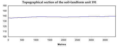
| Elevation range (m) | 113–184 | ||
| Local relief (m) | 3 | ||
| Drainage pattern | Centripetal–parallel | ||
| Drainage density (km/km2) | 2.1 | ||
| Landform | Plain | ||
| Landform element | Plains | Backplains | Open depressions |
| Slope and range (%) | 1 (0–4) | 1 (0–3) | 2 (1–5) |
| Slope shape | Straight | Straight | Concave |
| NATIVE VEGETATION Ecological Vegetation Class | Swamp Scrub (2.4%) | ||
| SOIL Parent material | Basaltic and sedimentary alluvium | Basaltic and sedimentary alluvium | Basaltic and sedimentary alluvium |
| Description (Corangamite Soil Group) | Neutral and alkaline black cracking clays (31) | Neutral mottled black texture contrast soils (32) | Neutral and alkaline black cracking clays (31) |
| Soil type sites | |||
| Surface texture | Clay | Loam, fine sandy | Clay |
| Permeability | Low | Low | Very low |
| Depth (m) | >2 | >2 | >2 |
| LAND CHARACTERISTICS, POTENTIAL AND LIMITATIONS | Strongly structured, but limited site drainage. Highly expansive clays. Moderate to high organic matter content of surface soils. | Texture contrast with expansive heavy subsoil. Sodic at depth. Moderate to high organic matter content of surface soils but bleached subsurface horizon. | Strongly structured, but very poor site drainage. Highly expansive clays. Moderate to high organic matter content of surface soils |
© State of Victoria (Agriculture Victoria) 1996 - .

This work, Victorian Resources Online, is licensed under a Creative Commons Attribution 4.0 licence. You are free to re-use the work under that licence, on the condition that you credit the State of Victoria (Agriculture Victoria) as author, indicate if changes were made and comply with the other licence terms.
The licence does not apply to ‘branding’ or some ‘images or photographs’ that may be owned by third parties. We ask you to seek prior approval to use images using the VRO feedback form. Access to higher quality images can also be provided on request.
This page was last updated on .