
6.2.5 Alluvium, alluvial terraces, floodplains and coastal plains of the Sedimentary Western Plains
|
Alluvium, alluvial terraces and floodplains are prevalent in the valley floors of the dissected sedimentary plains of the Heytesbury region. An extensive coastal plain occurs across the Moolap Sunkland, west of the uplifted Bellarine Block. This area was a shallow seaway both during the last interglacial (ca 125 000 years ago) and the Holocene maximum (ca 6000 years ago) (Marsden 1988). | 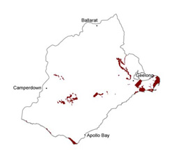 |
Soil-landform unit | Original unit ID | Unit description | Area (km2) |
20 | Alluvial plain and valley sides (Moorabool River) | 76 | |
311 | Elevated longitidinal coastal dunes (Cape Otway) | 34 | |
- | Undulating rises and plains (St Leonards) | 24 | |
| Barwon River L.S. | Floodplain (Barwon River and its tributaries) | 27 | |
| Gellibrand River L.S. | Floodplain (Gellibrand, Aire and Barham rivers) | 3 | |
137 | Gently undulating lunettes (Bungador) | 2 | |
116 | Alluvial plain (Pirron Yallock) | 37 | |
221 | Alluvial plain (Waurn Ponds) | 1 | |
144 | Gently undulating plain (east of Inverleigh) | 1 | |
118 | Near-level plains (Point Henry) | 3 | |
211 | Gently undulating plain (east of Inverleigh) | 10 | |
218 | Undulating plains (Barwon Heads) | 10 | |
- | Level and gently undulating plains (Yarram Creek) | 52 | |
| Point Roadknight L.S. | Longitudinal coastal dunes | 5 | |
- | Dunefield; undulating plains and rises (Point Lonsdale) | 12 | |
2 | Swamps and depressions (south of Swan Marsh) | 72 | |
138 | Swamps and flats (Leslie Manor) | 11 | |
| Connewarre L.S. | Flat estuarine lowlands with braided channels | 6 |
© State of Victoria (Agriculture Victoria) 1996 - .

This work, Victorian Resources Online, is licensed under a Creative Commons Attribution 4.0 licence. You are free to re-use the work under that licence, on the condition that you credit the State of Victoria (Agriculture Victoria) as author, indicate if changes were made and comply with the other licence terms.
The licence does not apply to ‘branding’ or some ‘images or photographs’ that may be owned by third parties. We ask you to seek prior approval to use images using the VRO feedback form. Access to higher quality images can also be provided on request.
This page was last updated on .