
Soil/Landform Unit 120
Landform Unit Description
Page top
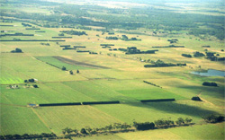 Gently undulating rises south-east of Colac. Soils are quite productive where well drained |
0.04% of CMA region The gently undulating rises around the base of Mounts Meningorot, Koang and Kurweeton has variable amounts of surface stones that have yielded good crops where surface stones are few. This single unit is adjacent to other volcanic units to the southeast of Camperdown and is close to the boundary with the Neogene sedimentary terrain to the south-west. As part of the volcanic Western Plains, the rises are characterised by broad gentle crests and slopes that graduate towards defined drainage lines. The rises have little remnant vegetation with less than 1% Plains Grassy Woodland remaining. The slopes and broad crests have shallow red and black friable loams, while the drainage depressions are found to have loams and mottled black texture contrast soils. Land use is mainly grazing (dairy and beef cattle mainly) with some cropping. This cropping is also limited by seasonal waterlogging of the lower slopes and depressions. | 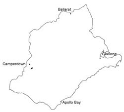 |
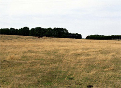 Gentle rises with well grassed slopes are mainly used for grazing and cropping | 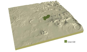 |
 |
Component | 1 | 2 | 3 |
Proportion of soil-landform unit | 25% | 72% | 3% |
| CLIMATE Rainfall (mm) | Annual: 760 | ||
| Temperature (oC) | Minimum 9, Maximum 19 | ||
| Precipitation less than potential evapotranspiration | October-March | ||
| GEOLOGY Age and lithology | Quaternary basalt and minor scoria, Recent clay, sand and gravel | ||
| Geomorphology | |||
| LANDUSE | Uncleared: Nature conservation Cleared: Cropping; beef cattle and sheep grazing; dairy | ||
| TOPOGRAPHY Landscape | Gently undulating rises | ||
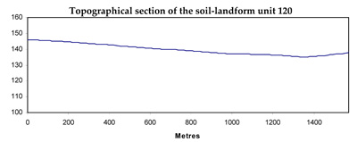
| Elevation range (m) | 125-164 | ||
| Local relief (m) | 20 | ||
| Drainage pattern | Radial | ||
| Drainage density (km/km2) | 1.9 | ||
| Landform | Undulating rises and plains | Drainage depressions | |
| Landform element | Broad gentle crests and upper slopes | Long gentle slopes and plains | Drainage depressions |
| Slope and range (%) | 1 (0-4) | 1 (0-3) | 2 (1-5) |
| Slope shape | Convex | Straight | Concave |
| NATIVE VEGETATION Ecological Vegetation Class | Plains Grassy Woodland (0.9%) | ||
| SOIL Parent material | Scoria, ash, basalt | Scoria, ash, basalt | Scoria, ash, basalt and colluvium |
| Description (Corangamite Soil Group) | Shallow red and black friable loams (40) | Shallow red and black friable loams (40) | |
| Soil type sites | |||
| Surface texture | Clay loam | Clay loam | Clay loam, light clay |
| Permeability | High | High | Low to moderate |
| Depth (m) | <0.7 | <1 | <1.5 |
| LAND CHARACTERISTICS, POTENTIAL AND LIMITATIONS | Uniform loam, low to moderate water holding capacity and high nutrient holding capacity. Friable, but often stony. Highly permeable, especially shallower profiles. | Uniform loam, low to moderate water holding capacity and high nutrient holding capacity. Friable, but often stony. Highly permeable, especially shallower profiles. | Uniform loam and some texture contrast, low to moderate water holding capacity and nutrient holding capacity in upper soil, higher in subsoil. Friable, but often stony. Higher permeability on shallower profiles. some compaction and nutrient decline possible in upper part of texture contrast soil. |
© State of Victoria (Agriculture Victoria) 1996 - .

This work, Victorian Resources Online, is licensed under a Creative Commons Attribution 4.0 licence. You are free to re-use the work under that licence, on the condition that you credit the State of Victoria (Agriculture Victoria) as author, indicate if changes were made and comply with the other licence terms.
The licence does not apply to ‘branding’ or some ‘images or photographs’ that may be owned by third parties. We ask you to seek prior approval to use images using the VRO feedback form. Access to higher quality images can also be provided on request.
This page was last updated on .