
Soil/Landform Unit 103
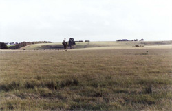 Rises of scoria and basalt near Irrewarra. These soils and a sufficient rainfall make this area extremely versatile for potential land uses |
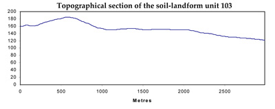
0.06% of CMA region The low hills and rises east of Irrewarra (near Colac) are derived from volcanic scoria and basalt that is evident in a cutting on the outskirts of Colac when heading towards Winchelsea. This volcanic eruption point on the Western Plains has nearly 45 m of local relief. The low hill has little remnant vegetation (less than 2%) with the major vegetation class being Grassy Woodland. These remnants occur mainly as sporadic stands across the landscape. The hills and rises have highly fertile side slopes and footslopes that have been used for cereal production and are currently under residential development. The basaltic rock and scoria support mottled texture contrast soils with shallow black cracking clays, though basalt floaters and outcrops make cultivation difficult on certain slopes. Slumping and nutrient decline are minor degradation issues of these low hills. | 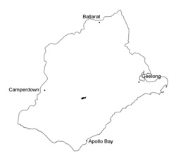 |
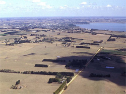 Volcanic derived low hills and rises located on this ner side of Colac | 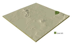 |
 |
Component | 1 | 2 | 3 | 4 | 5 |
Proportion of soil-landform unit | 20% | 15% | 10% | 40% | 15% |
| CLIMATE Rainfall (mm) | Annual: 550 | ||||
| Temperature (oC) | Minimum 9, Maximum 19 | ||||
| Precipitation less than potential evapotranspiration | November-March | ||||
| GEOLOGY Age and lithology | Quaternary scoria and minor basalt, Neogene marine marl and fluvio-marine sand | ||||
| Geomorphology | |||||
| LANDUSE | Uncleared: Nature conservation Cleared: Sheep and beef cattle grazing; cropping (cereal) | ||||
| TOPOGRAPHY Landscape | Undulating low hills and rises | ||||
| Elevation range (m) | 45-147 | ||||
| Local relief (m) | 45 | ||||
| Drainage pattern | Centipetal | ||||
| Drainage density (km/km2) | 0.9 | ||||
| Landform | |||||
| Landform element | Low hills and rises | Plains | |||
| Slope and range (%) | Broad low crests | Upper slopes | Mid slopes | Lower slopes | Long gentle slopes and plains |
| Slope shape | 2 (1-5) | 5 (3-10) | 8 (5-15) | 3 (1-8) | 1 (0-5) |
| NATIVE VEGETATION Ecological Vegetation Class | Grassy Woodland 1.6% | ||||
| SOIL Parent material | In situ basalt | In situ basalt | In situ basalt and colluvium | In situ basalt and colluvium | In situ basalt and colluvium |
| Description (Corangamite Soil Group) | Alkaline mottled brown, grey or yellow texture contrast soils (36) | Alkaline mottled brown, grey or yellow texture contrast soils (36) | Alkaline mottled brown, grey or yellow texture contrast soils (36) | Alkaline mottled brown, grey or yellow texture contrast soils (36) | |
| Soil type sites | |||||
| Surface texture | Fine sandy clay loam | Fine sandy clay loam | Fine sandy clay loam | Fine sandy clay loam | Fine sandy clay loam |
| Permeability | Low to moderate | Low to moderate | Low to moderate | Low | Low to very low |
| Depth (m) | <1.5 | <1.5 | <2 | 1.5-2.5 | 1.5-2.5 |
| LAND CHARACTERISTICS, POTENTIAL AND LIMITATIONS | Texture contrast shallow, low water holding capacity and moderate nutrient holding capacity in shallow surface and subsurface soils, higher in deep subsoil Yellow (brown) soils have low permeability. Strongly sodic subsoil. Moderately rapid site drainage. | Texture contrast soil, low water holding capcity and moderate nutrient holding capacity in shallow surface and subsurface soils, higher in deep subsoil. Yellow (brown) soils have low permeability. Strongly sodic subsoil. Moderately rapid to rapid site drainage. | Texture contrast soil, low water holding capacity and moderate nutrient holding capacity in shallow surface and subsurface soils, higher in deep subsoil. Yellow (brown) soils have low permeability. Strongly sodic subsoil. Moderately rapid to rapid site drainage. | Texture contrast soil, low water holding capacity and moderate nutrient holding capacity in shallow surface and subsoils soils, higher in deep subsoil. Yellow (brown) soils have low permeability. Strongly sodic subsoil. Slow site drainage. | Texture contrast soil, low water holding capacity and moderate nutrient holding capacity in shallow surface and subsurface soils, higher in deep subsoil. Yellow (brown) soils have low to very low permeability. Strongly sodic subsoil. Slow site drainage. |
© State of Victoria (Agriculture Victoria) 1996 - .

This work, Victorian Resources Online, is licensed under a Creative Commons Attribution 4.0 licence. You are free to re-use the work under that licence, on the condition that you credit the State of Victoria (Agriculture Victoria) as author, indicate if changes were made and comply with the other licence terms.
The licence does not apply to ‘branding’ or some ‘images or photographs’ that may be owned by third parties. We ask you to seek prior approval to use images using the VRO feedback form. Access to higher quality images can also be provided on request.
This page was last updated on .