
NA174
| ||||
|
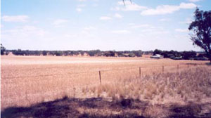
Location | Gymbowen, western Victoria | |||
|
Landform | Gently Undulating Plain | |||
|
Geology | Pliocene Parilla Sand: marine sand and silt | |||
|
Element | Hillcrest | |||
Description | ||||
Horizon | Depth (cm) | |||
A1 | 0–10 | Dark yellowish brown (10YR3/4); sandy loam; weakly structured; weak consistence, dry; pH 6.0; sharp boundary to: | ||
A2 | 10–30 | Yellowish red (5YR4/4); sporadically bleached (5YR7/3d); sandy loam; weak consistence, dry; pH 6.3; sharp boundary to: | ||
B2 | 30–80+ | Yellowish red (5YR5/8); medium clay; very strong consistence, slightly moist; pH 7.4. | ||
| Management considerations | ||||
| ||||
Horizon | Depth (cm) | pH (water) | pH (CaCl2) | EC dS/m | Exchangeable Cations cmol-/kg | Field Capacity (pF2.5) | Wilting Point (pF4.2) | |||
Ca | Mg | K | Na | |||||||
A1 | 0–10 | 6.0 | 5.0 | 0.10 | 3.9 | 1.1 | 0.5 | 0.1 | 11.2 | 6.5 |
A2 | 10–30 | 6.3 | 5.2 | 0.02 | 2.5 | 0.7 | 0.2 | 0.0 | 8.6 | 4.1 |
B21 | 30–80+ | 7.4 | 6.2 | 0.13 | 4.9 | 5.5 | 0.3 | 2.7 | 26.2 | 18.7 |
© State of Victoria (Agriculture Victoria) 1996 - .

This work, Victorian Resources Online, is licensed under a Creative Commons Attribution 4.0 licence. You are free to re-use the work under that licence, on the condition that you credit the State of Victoria (Agriculture Victoria) as author, indicate if changes were made and comply with the other licence terms.
The licence does not apply to ‘branding’ or some ‘images or photographs’ that may be owned by third parties. We ask you to seek prior approval to use images using the VRO feedback form. Access to higher quality images can also be provided on request.
This page was last updated on .