
Soil/Landform Unit - Elmhurst footslopes
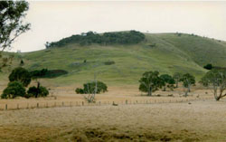 Footslopes at the base of a hill near Elmhurst |
0.04% of CMA region Footslopes scattered around the base granitic mountains in the Upper Wimmera River catchment are characterised by moderately steep upper slopes that become gentle lower in the topographic sequence. The footslopes often reflect a minor portion of a once significant metamorphic envelope that sourrounded the granite prior to significant erosion of these landscapes. Soils on these slopes include red and yellow texture contrast soils that may be sodic (Sodosols or Chromosols). Soils tend to be friable with hardsetting equivalents in drier areas more prone to sheet and rill erosion. The two main vegetation communities of the footsllsopes are Grassy Dry Forest and Hills Herb-rich Woodland. |  |
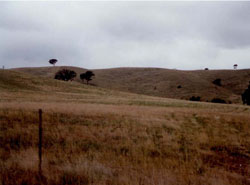 Long gentle footslopes with sparse remnant vegetation | 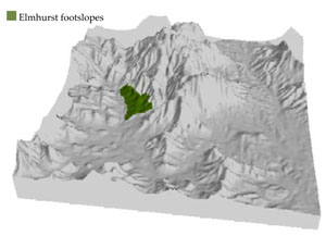 |
 | 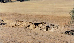 Gully and tunnel erosion |
Component | 1 | 2 | 3 |
Proportion of soil-landform unit | 15% | 75% | 10% |
| CLIMATE Rainfall (mm) | Annual: 710 | ||
| Temperature (oC) | Minimum 7, Maximum 18 | ||
| Precipitation less than potential evapotranspiration | October–March | ||
| GEOLOGY Age and lithology | |||
| Geomorphology | |||
| LANDUSE | Uncleared areas: wWater supply; nature conservation; recreational activities Cleared areas: sSheep grazing; water supply; viticulture; dryland cropping | ||
| TOPOGRAPHY Landscape | Low hills and footslopes | ||
| Elevation range (m) | 255–429 | ||
| Local relief (m) | 40 | ||
| Drainage pattern | Dendritic–parallel | ||
| Drainage density (km/km2) | 0.6 | ||
| Landform | Hillslopes | ||
| Landform element | Moderate upper slope | Gentle mid slope | Drainage line |
| Slope and range (%) | 22 (20-35) | 7 (3-20) | 2 (1-6) |
| Slope shape | Convex | Convex | Concave |
| NATIVE VEGETATION Ecological Vegetation Class | Hills Herb-rich Woodland (47.3%), Grassy Dry Forest (31.6%) | ||
| SOIL Parent material | In situ granite | In situ granite, sandstone, siltstone and biotite schist | Fluvial gravel, sand and silt |
| Description (Corangamite Soil Group) | Red texture contrast soils (1) | Sodic yellow texture contrast soils (4) | |
| Soil type sites | |||
| Surface texture | Fine sandy loam | Fine sandy loam - silty loam | Clayey coarse sand |
| Permeability | Moderate | Moderate to slow | Slow |
| Depth (m) | 0.7 | 0.7–1.4 | < 2 |
| LAND CHARACTERISTICS, POTENTIAL AND LIMITATIONS Critical land features, processes, forms | Friable with better infiltration in moister areas, hardsetting and more prone to sheet and rill erosion in drier areas (north and westerly aspects). Susceptible to acidification in wetter areas. | Soils are friable with better infiltration in moister areas, hardsetting and more prone to sheet and rill erosion in drier areas (including drier aspects). Sodic subsoil prone to gully and tunnel erosion. Susceptible to acidification in wetter areas. | Light loose surface soils susceptible to wind, sheet and rill erosion in drier areas. Sodic subsoil susceptible to gully erosion. Poor subsurface drainage, particularly on flats and gentle slopes. Surface soils susceptible to acidification. |
© State of Victoria (Agriculture Victoria) 1996 - .

This work, Victorian Resources Online, is licensed under a Creative Commons Attribution 4.0 licence. You are free to re-use the work under that licence, on the condition that you credit the State of Victoria (Agriculture Victoria) as author, indicate if changes were made and comply with the other licence terms.
The licence does not apply to ‘branding’ or some ‘images or photographs’ that may be owned by third parties. We ask you to seek prior approval to use images using the VRO feedback form. Access to higher quality images can also be provided on request.
This page was last updated on .