
Tanjil River DWSC
To view the information PDF requires the use of a PDF reader. This can be installed for free from the Adobe website (external link).
Report on the Tanjil River Catchment. A Proposal for Proclamation prepared for consideration by the Land Conservation Council, June 1979:
 | (PDF - 355KB) |
Report on the Tanjil River Catchment. A Proposal for Proclamation prepared for consideration by the Land Conservation Council, June 1979
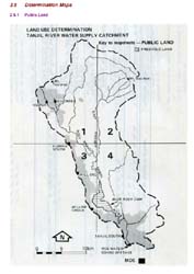
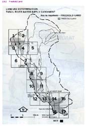
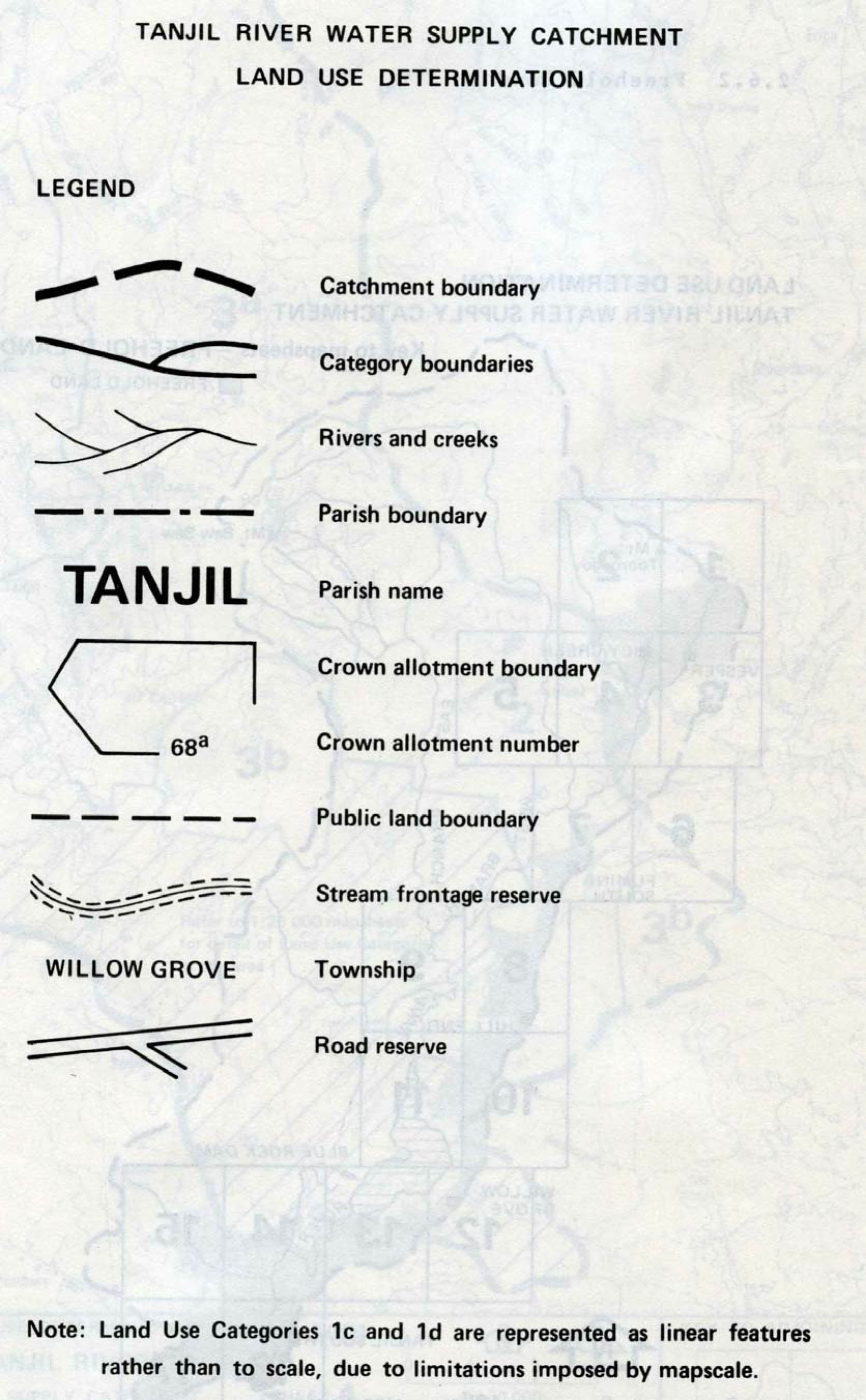
Report on proposed Land Use Determination for the Tanjil River Water Supply Catchment, prepared by LD Russell, Catchment Investigation Officer of the former Soil Conservation Authority in 1985.
 | Front Page and Table of Contents (PDF 14KB) | |
1 | Introduction (PDF 306KB) | |
2 | The Land Use Determination (PDF 62KB) | |
3 | Water Supply Hazards (PDF 20KB) | |
4 | Details of Water Supply (PDF 18KB) | |
5 | Biophysiography (PDF 223KB) | |
6 | Land Tenure and Use (PDF 332KB) |
Report on proposed Land Use Determination for the Tanjil River Water Supply Catchment
Report on Tanjil River Catchment - a description of land & its capability for development.
This report was prepared in 1982 by Martin Wells of the former Soil Conservation Authority. It forms part of a two year study into the capability of land in the Central Gippsland region to sustain further development for residential purposes in the light of expanding mining and industrial development of the La Trobe Valley. The study undertook to provide information on the capability of land for urban and rural residential purposes in those areas of the region that were largely outside the existing coal protection and industrial zones. It was intended as an aid to land use planning. The information presented here was also a major input into the preparation of a Land Use Determination for the Tanjil River Catchment.
Volume 1 - Tanjil River Catchment - A description of land & its capability for development.
 | Foreword Acknowledgement Summary and Conclusions Conclusions (PDF 166KB) | |
| 1. | Introduction (PDF 162KB) | |
| 1.1 Location of Study Area | ||
| 1.2 Purpose of the Study | ||
| 1.3 Land Capability | ||
| 2. | Study Procedure (PDF 172KB) | |
| 2.1 Land Inventory | ||
| 2.2 Land Capability Assessment | ||
| 2.3 Presentation of Results | ||
| 3. | General Description of the Environment (PDF 321KB) | |
| 3.1 General Locality Description | ||
| 3.2 Climate | ||
| 3.3 Landform, Geology and Soils | ||
| 3.4 Existing Vegetation | ||
| 3.5 Land Tenure and Use | ||
| 3.6 Existing Erosion | ||
| 4. | Description and Assessment of Map Units (PDF 248KB) | |
| 4.1 Index to Map Units | ||
| 5. | Summary of the Capability Ratings (PDF 192KB) | |
| 6. | How the Ratings can be used (Freehold Land Only) (PDF 122KB) | |
| References (PDF 96KB) | ||
| Appendices (PDF 324KB) |
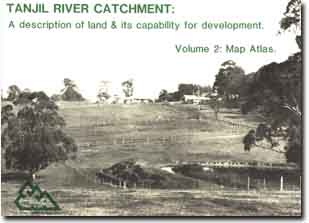
Volume 2 - Tanjil River Catchment - A description of land & its capability for Development - Map Atlas
 | 1. | Introduction (PDF 197KB) |
| 2. | Index to Map Sheets (PDF 165KB) | |
| 3. | Land Inventory Maps (PDF 845KB) | |
| 4. | Land Capability Maps | |
| 4a. Rural Residential Development (PDF 1.3MB) | ||
| 4b. General Construction Activities (PDF 1.5MB) | ||
| 4c. On Site Effluent Disposal (PDF 1.0MB) | ||
| 4d. Erosion Risk (PDF 1.3MB) |
Volume 2 - Tanjil River Catchment - A description of land & its capability for Development - Map Atlas
Further information on Victoria's Declared Water Supply Catchments
© State of Victoria (Agriculture Victoria) 1996 - 2025.

This work, Victorian Resources Online, is licensed under a Creative Commons Attribution 4.0 licence. You are free to re-use the work under that licence, on the condition that you credit the State of Victoria (Agriculture Victoria) as author, indicate if changes were made and comply with the other licence terms.
The licence does not apply to ‘branding’ or some ‘images or photographs’ that may be owned by third parties. We ask you to seek prior approval to use images using the VRO feedback form. Access to higher quality images can also be provided on request.
This page was last updated on 25/01/2019.