
5.6 Hills and low hills (Mt. Arapiles, Mitre Rock, Mt. Jeffcott)
5. North Western Dunefields and Plains (DP)
| A number of topographically significant and materially different features appear within the Northwest Dunefields and Plains (DP) as inliers. This is a similar category to that within the Northern Riverine Plains (RP), namely 4.4 (Tier2). The major inliers consist the largest inlier, Mt. Arapiles and associated outlier (Mitre Rock) as well as Mt. Jeffcott and lower weathered Palaeozoic sediments often subsumed by surfical deposits. The Mt. Arapiles complex is to the WNW of the Grampians, relatively square in plan with an area of approximately 15km2, has steep to precipitous slopes and a relatively flat summit at about 300 m elevation, unlike the sharper ridges of the Grampians of similar material and geologial age. The Mt. Arapiles complex is bound by the Douglas Depression (5.3.3) as well as Ridges with sand and flats (5.5.2). The Mt. Jeffcott complex comprises a generally low north/south aligned ridge with the steeper and higher southern peak at 262 m elevation and an area of about 10 km2 with gentle slopes apart from those around the main peak. It is bound by Dunefields and plains (DP) to the west and south and the Northern riverine plains (RP) to the north and east. This ridge forms part of the catchment divide between the Avoca and Avon/Richardson River catchments. The Mt. Arapiles complex is made up of Grampians sandstone with the Douglas Depression diverted around it, indicating some form of structural control. It is abutted by stranded beach ridges and a marine cut shoreline at its base is evident. The Mt. Jeffcott complex comprises a metamorphic ridge, with associated granitic outcrop at the northern end. | 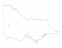 |
Regolith development is correlated with landscape position; the steeper, stripped slopes having relatively shallow depth to rock, sometimes rock outcrop. Broader crests may have greater regolith development as do lower, gentler slopes; generally colluvial.
Soil types tend to be Tenosols and Kandosols, sandy throughout, with Rudosols on rocky areas and occasional texture contrast soils on the lower slopes (Chromosols, Sodosols). Vegetation patterns reflect moisture availability and storage ability of the soils and regolith.
The steep to precipitous slopes of Mt. Arapiles attract rock climbing enthusiasts. The coarse sand nature of much of the surface soil/regolith has a high potential for sheet erosion, where fines can be easily disaggregated and transported.
Related information on VRO
- Soil Associations of Horsham Map sheet No. 7324 (N Badawy 1977)
- A Study of the Land in the Grampians Area (G T Sibley 1967)
© State of Victoria (Agriculture Victoria) 1996 - .

This work, Victorian Resources Online, is licensed under a Creative Commons Attribution 4.0 licence. You are free to re-use the work under that licence, on the condition that you credit the State of Victoria (Agriculture Victoria) as author, indicate if changes were made and comply with the other licence terms.
The licence does not apply to ‘branding’ or some ‘images or photographs’ that may be owned by third parties. We ask you to seek prior approval to use images using the VRO feedback form. Access to higher quality images can also be provided on request.
This page was last updated on .